Good News from Iraq – Arthur Chrenkoff highlights two weeks’ worth of good news from Iraq
Day 9 — Rocky Mountain National Park, May 2005
In May 2005, Rachelle and I took a vacation to Colorado. We spent the last few days of our vacation visiting Rocky Mountain National Park. After driving up Kawuneeche Valley on the western end of Trail Ridge Road, and then hiking and photographing Bear Lake and Horseshoe Park, I decided to get up and take some early morning photographs in the park.
Lily Lake
My first stop was Lily Lake. I was interested in photographing someplace new and as we hadn’t come here the day before, and the drive was short, Lily Lake fit my plan nicely.
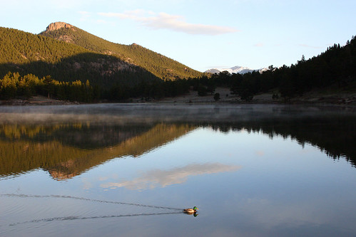 A mallard glides gracefully upon the lake.
 Here’s a close-up of the mallard.
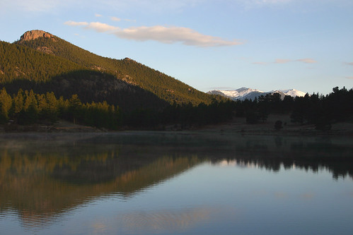 I wasn’t disappointed in the beautiful scenery at Lily Lake.
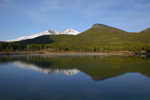 I walked a bit around the lake to take some photos of Longs Peak.
 Here’s a closer view of Longs Peak.
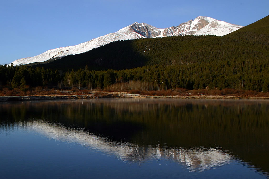
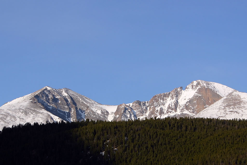 And this is a closer view of the summit of Longs Peak.
Sprague Lake
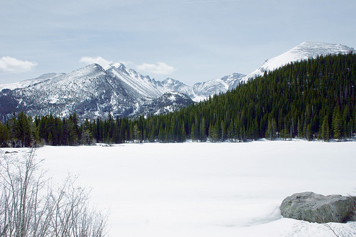
Next, I drove back to Sprague Lake. This early in the morning, it was just myself, the elk and the mallards that were enjoying the scenery.
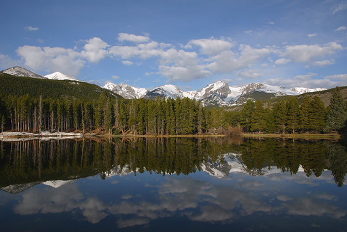
 The surface of Sprague Lake was like a mirror. This photo is similar to one I took the day before.
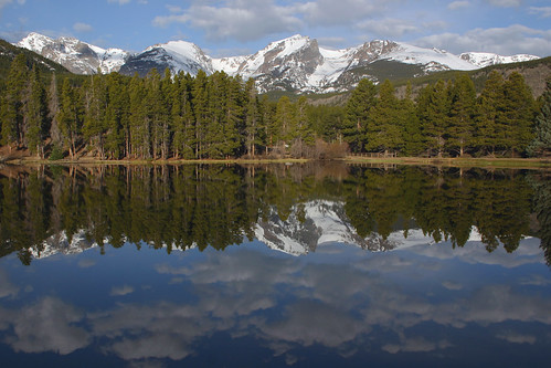
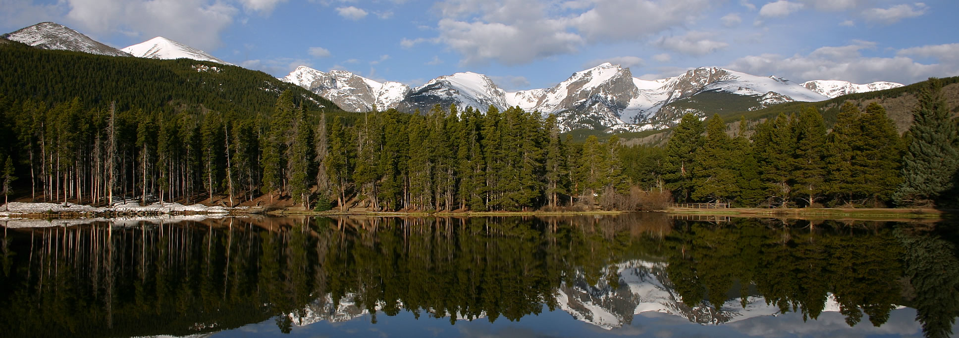
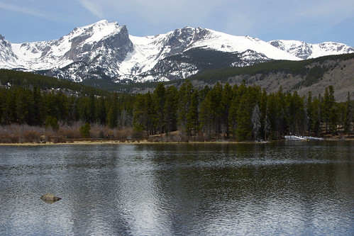
 This photo shows Sprague Lake with Hallett Peak, Flattop Mountain and Tyndall Glacier in the background, and their reflections in the lake as well.
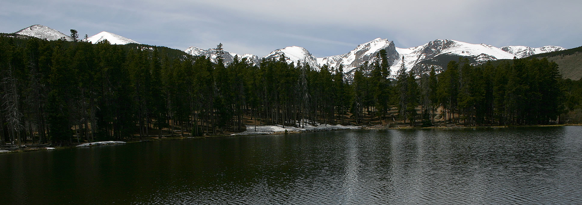
 This photo is also similar to one I took on the previous day. In addition, I have a panoramic photograph of this scene.
Moraine Park
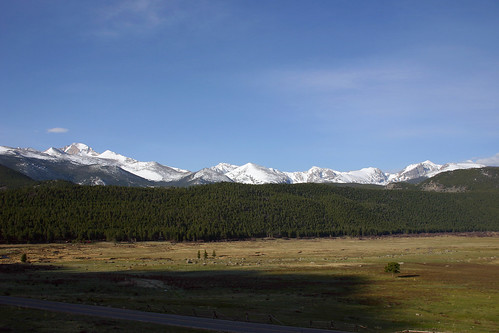
As I was leaving the park, I stopped in Moraine Park to take some photos.
 Hallett Peak is on the very left end of this photograph.
 These mountains rise out of the west end of Moraine Park.
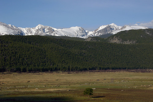
 Hallett Peak sticks out just above the ridge.
 A close-up view of Hallett Peak and Flattop Mountain.
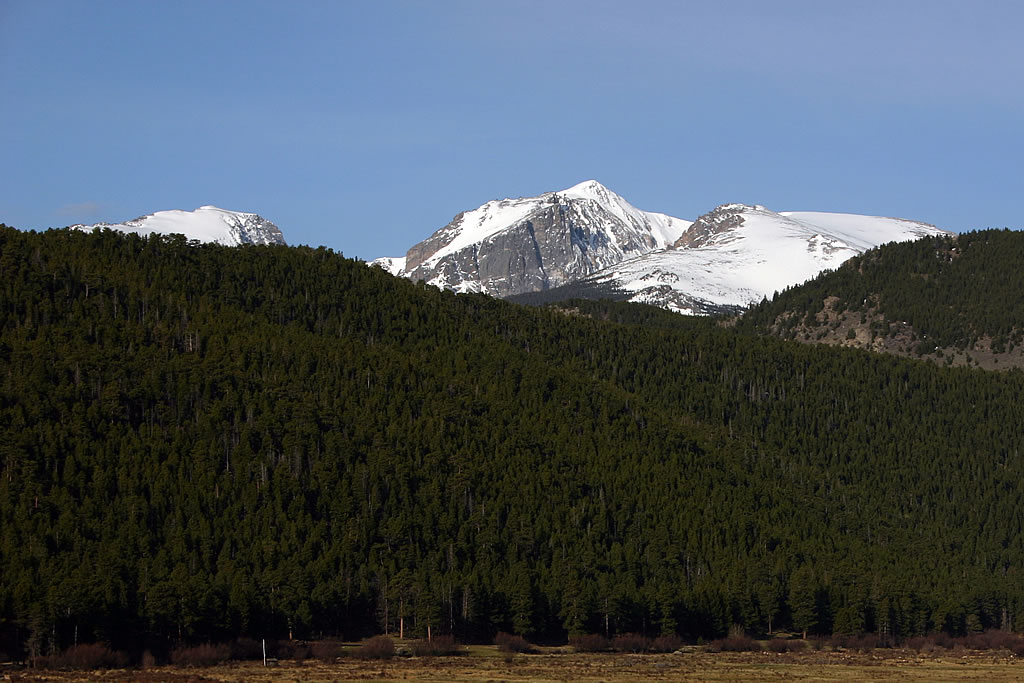
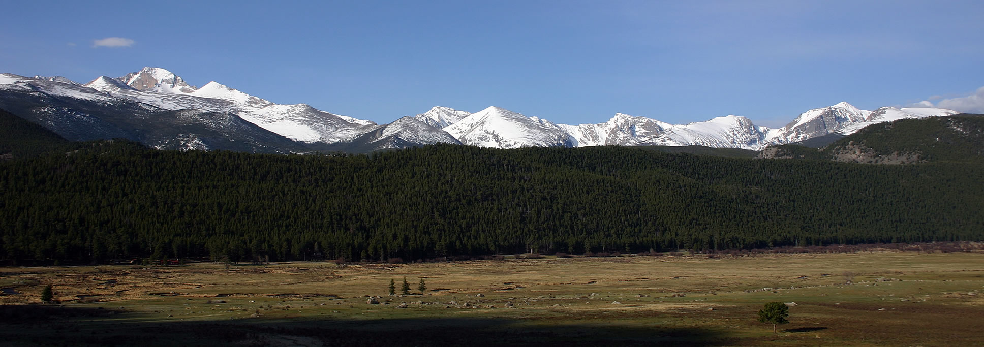
 The mountain scenery south of Moraine Park. Longs Peak is on the left and Hallett Peak is on the right. I also have a panoramic photo of this stunning view.
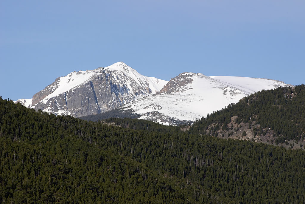
 Longs Peak rises majestically above Moraine Park.
 One last photo of the breathtaking scenery in Rocky Mountain National Park.
After I returned to the hotel, Rachelle and I packed up our belongings, drove to the airport and returned home. Our vacation was over.
Day 8 — Rocky Mountain National Park, May 2005
In May 2005, Rachelle and I took a vacation to Colorado. We spent the last few days of our vacation visiting Rocky Mountain National Park. After driving up Kawuneeche Valley on the western end of Trail Ridge Road, we then drove to the eastern side of Rocky Mountain National Park.
Bear Lake
After a stop at the Beaver Meadows Visitor Center, we decided to drive down to Bear Lake and take a short hike out to Nymph Lake.
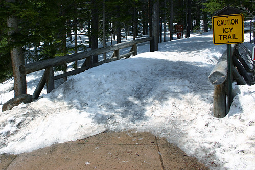 This was the scene that greeted us when we arrived at the trail head.
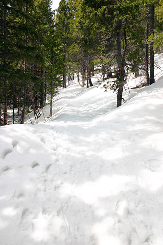 I wouldn’t say the trail was icy–it was merely covered in about three feet of snow.
 Eventually, we stopped to take a break, and decided we were not adequately prepared to be sloshing around in all this snow. The trail seemed to be getting steeper, and we were concerned about getting back down safely. So we opted to return to the trail head and hike around Bear Lake instead.
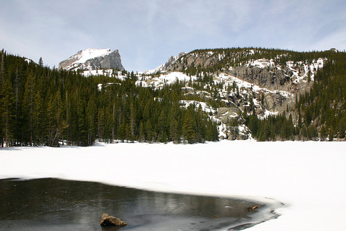 Bear Lake was almost completely frozen and covered with snow. Only the part at the bottom of this photo was free of ice and snow. The mountain to the left is Hallett Peak with Flattop Mountain to the right.
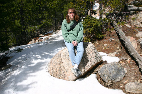
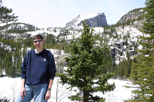 Here I am posing for a photo with Hallett Peak in the background. Both Hallett Peak and Flattop Mountain are on the Continental Divide.
 Here’s another photo of the surface of Bear Lake, completely covered with snow. The trail was also buried under snow. At various points along the trail, we could see the tops of the trail fences sticking up through the snow.
Sprague Lake
Next, we headed to Sprague Lake and took a short hike around the lake.
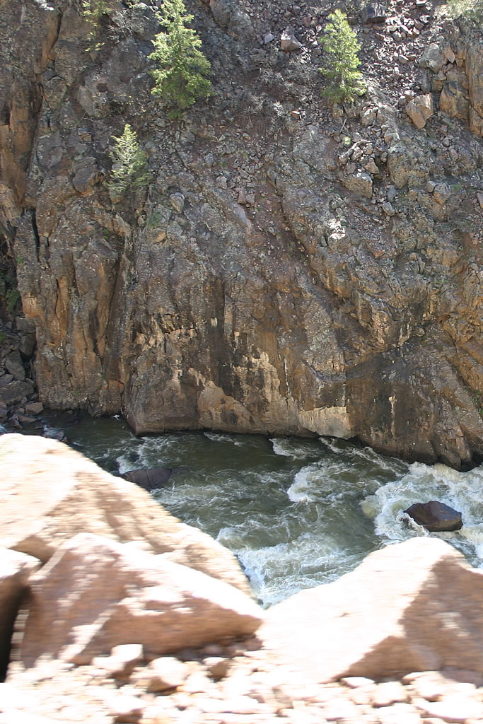
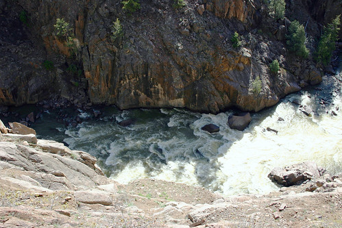
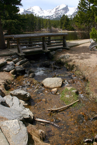 Sprague Lake drains into this stream. The mountain in the background is Hallett Peak.
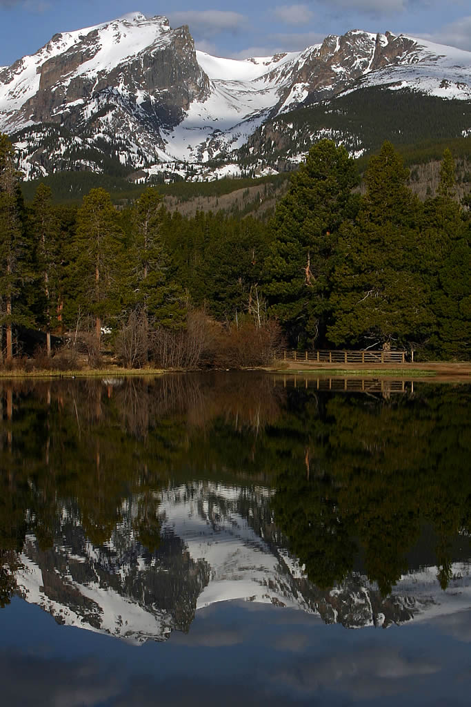
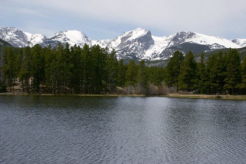 Here’s a better view of the lake. Hallett Peak is in the center of this photo with Flattop Mountain to the right. Between them is Tyndall Glacier.
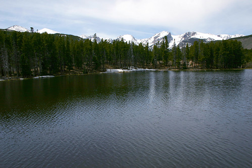 Here’s a wide angle shot of the mountains rising above Sprague Lake. I also have a panoramic photo of these mountains and the lake.
 One last photo of Hallett Peak towering over Sprague Lake.
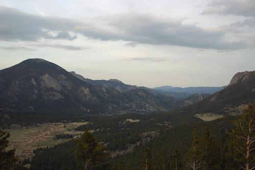
Rachelle and I had both caught a cold during our trip, and after lunch we were both feeling a bit run down. So we retired to our hotel room for some needed rest. After our nap we continued our exploration of the park by driving into Horseshoe Park, which we had visited the night before.
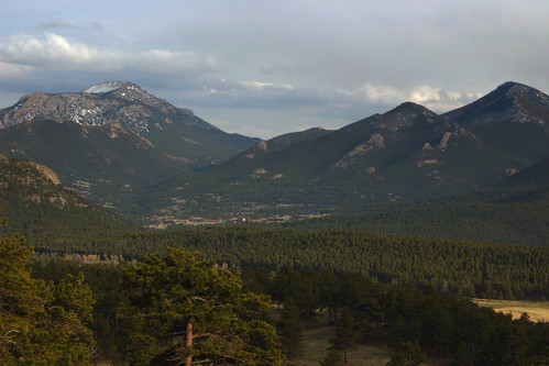 Along the way we stopped to take in the view. This is looking east towards Estes Park.
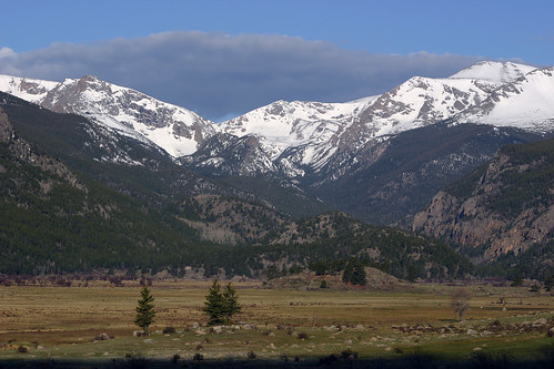
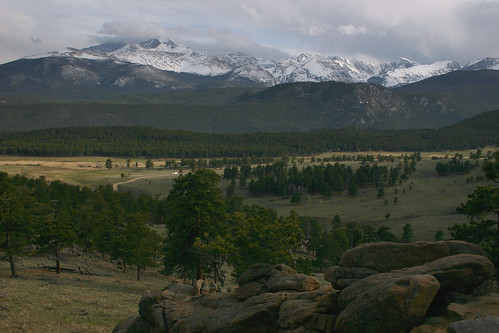 And this photo is looking out over Moraine Park at Longs Peak.
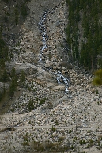
Alluvial Fan
On July 15, 1982 an earthen dam built on Lawn Lake for irrigation purposes failed. The U.S. Geological Survey website has before and after topographical maps, as well as aerial photos of the area. There is a short trail to a bridge over the Roaring River and an excellent close-up look at the debris that was left behind.
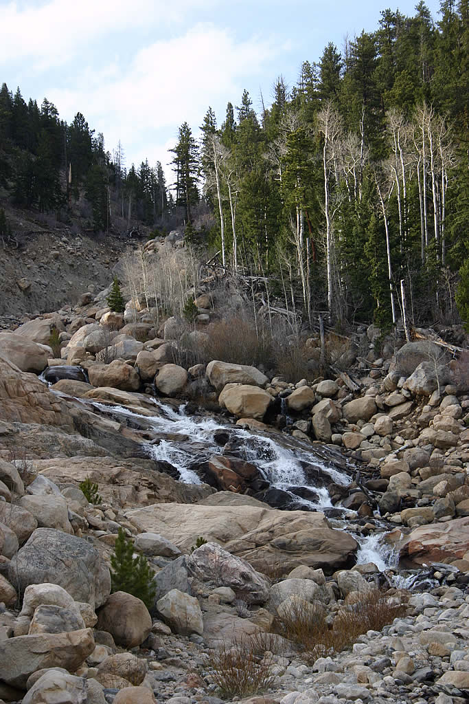
 The resulting flood waters deposited this debris, known as an alluvial fan, in Horseshoe Park at the mouth of the Roaring River. The debris also dammed up the Fall River creating a new lake in Horseshoe Park.
 In addition, the flood waters caused Cascade Dam father down Fall River to fail and flooded the town of Estes Park.
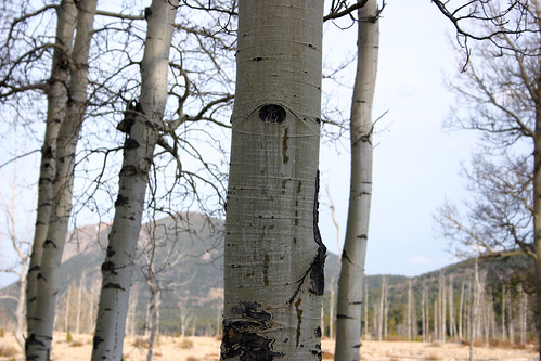
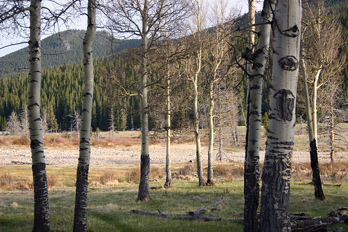 These aspen were growing in Horseshoe Park.
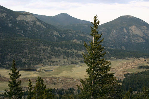
Many Parks Curve
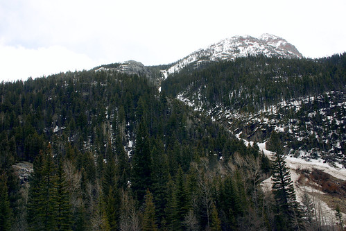
Next, we drove up to Many Parks Curve which is the farthest we could go on this end of Trail Ridge Road. The overlook wraps around a bend in the road, giving spectacular views of both Moraine and Horseshoe Parks.
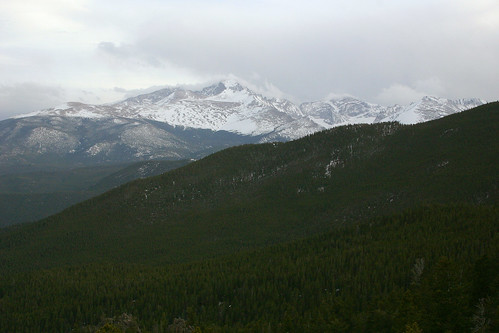 At 14,255 feet in elevation, Longs Peak is the tallest mountain in Rocky Mountain National Park.
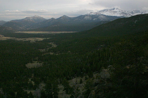 Longs Peak rises above Moraine Park.
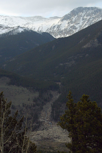 When Lawn Lake Dam failed, the flood waters gouged a channel out of the ground that remains twenty-three years later.
 The bridge in the middle of this photo is the footbridge where I took the earlier photos of the alluvial fan.
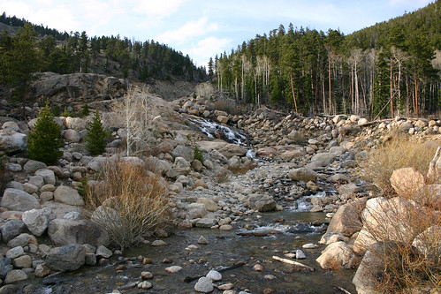
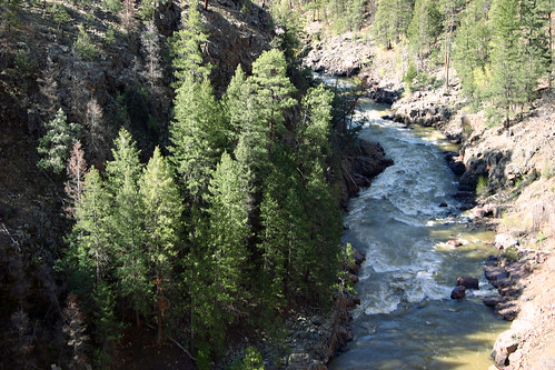
 This photo shows Horseshoe Park with Sheep Lakes on the lower left side, and the Fall River winding its way through the valley.
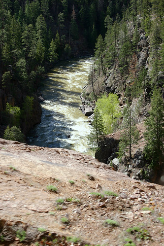
 The Fall River continues on its way farther down the valley.
At this point we called it a day. I made plans to get up the next day to take some photos at sunrise. *[U.S.]: United States
Day 7 — Rocky Mountain National Park, May 2005
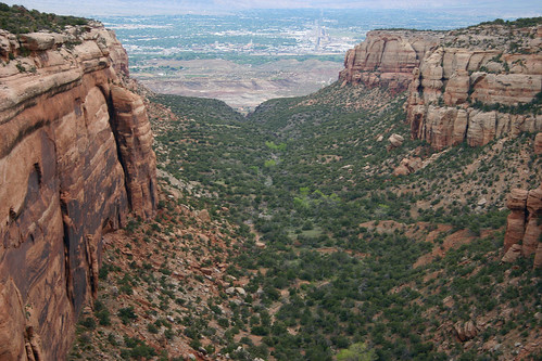
In May 2005, Rachelle and I took a vacation to Colorado. After our slight detour into Utah to visit Arches and Canyonlands National Parks, we returned to Colorado and drove the scenic Rim Rock Drive through Colorado National Monument before continuing on our way east. We planned to spend the next couple of days at Rocky Mountain National Park before heading home.
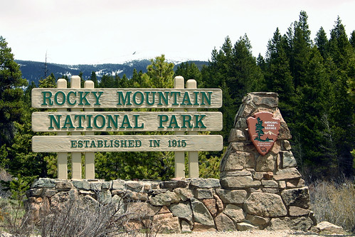
The obligatory photo of the park sign.
Kawuneeche Valley
Because Trail Ridge Road was closed for the winter, we couldn’t drive all the way through the park. So, on our way back east, we decided to visit the western section of the park before continuing on to Estes Park and the eastern portion of the park. We planned to drive as far up the road as we could, looking for wildlife and taking in the scenery along the way. I had heard before our trip that the park’s moose were to be found in this area of the park. First, we stopped at the Kawuneeche Visitor Center, where a ranger told us where several moose had been spotted recently. The ranger also showed us photos of the road crews that were working on clearing the snow off of Trail Ridge Road. With its highest elevation at 12,183 feet, Trail Ridge Road is the highest continuous paved road in the United States.
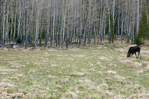
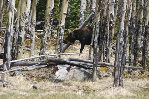
To our delight just after we had left the visitor center, we passed a clearing on our right with two moose grazing not far from the road. The second moose is at the left edge of the photo, just inside the woods.
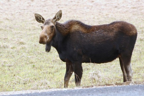
This one just seemed to go about his business grazing. Our presence didn’t seem to alarm him.
Moose are certainly a strange looking animal.
Uh-oh! I think we’ve been spotted.
We stayed and watched these two for a while.
The other moose stayed in the woods the entire time we were observing them.
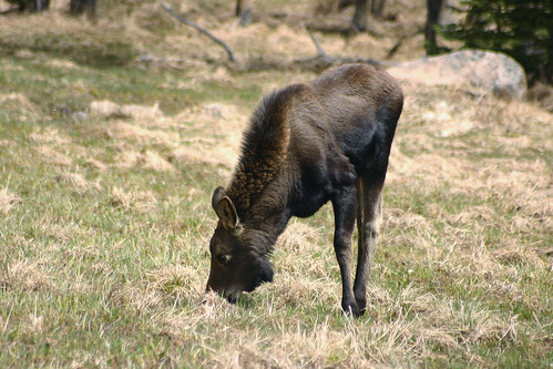
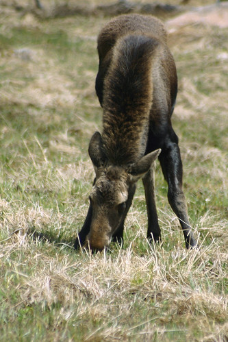
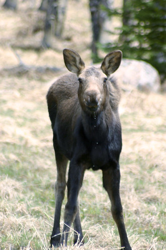
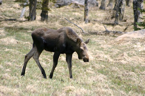
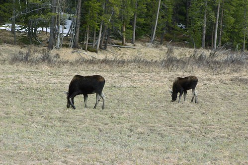
We resumed our drive up the valley excited that we had so easily seen some moose. Eventually, we passed another set of moose. One moose seemed smaller, so we supposed that this set was a mother and her yearling.

This is the younger moose.
The mother moose is standing watch not far away.
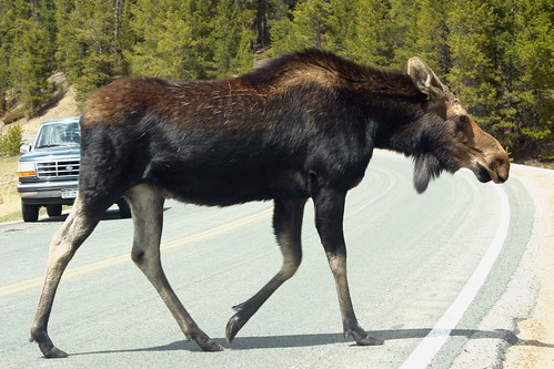
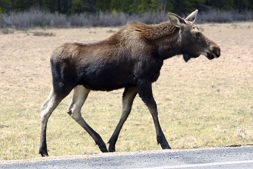
I was watching the yearling through my camera, when the older one started to cross the road. I hurriedly took this photo through my car’s windshield.
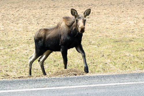
The yearling then noticed that his mother had left him, and he started across the road.
He paused at the side of the road…
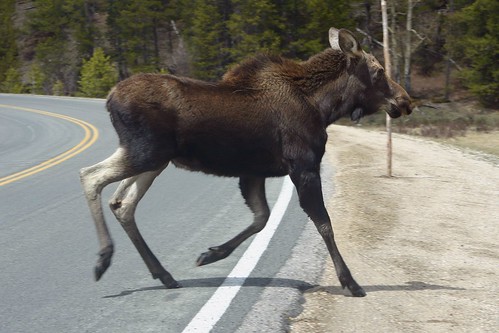
And then galloped his way over to the other side.
Mother and yearling were reunited on the other side of the road as we drove off.
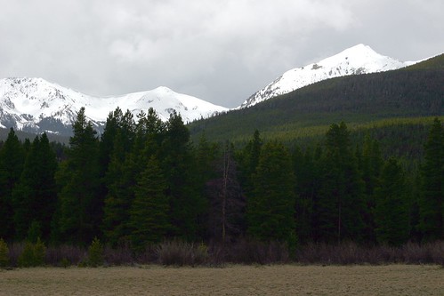
These are the snow-capped peaks of the Never Summer Mountains, which mark the western boundary of the park. We had driven through some bad weather on the way to the park, and it looked as if it was catching up to us.
We continued our drive as far as we could, returning the way we had come and enjoying the beautiful scenery along the way. Soon, we left this section of Rocky Mountain National Park and headed for the other side of the park.
Beaver Meadows
It was late in the day when we arrived at Estes Park, so we decided to head into the park in search of wildlife before the sun set.
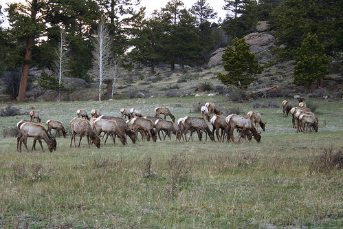
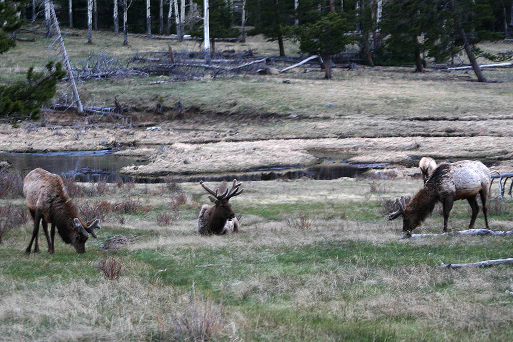
As we approached the Beaver Meadows Entrance Station, we saw a large herd of elk grazing in the nearby fields.
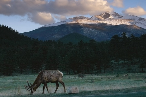
Towering above the clearing, Longs Peak is a silent sentinel. At 14,255 feet in elevation, it is the tallest mountain in Rocky Mountain National Park.
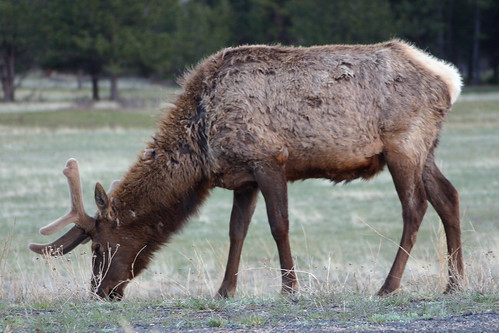
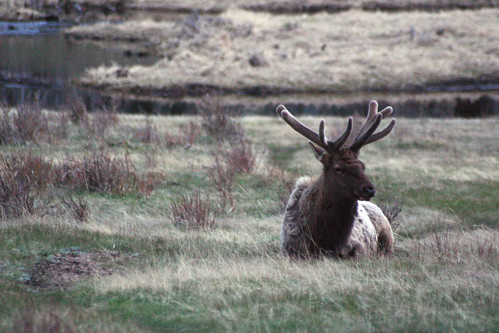
Here’s a close-up of the male elk from the previous photograph.
Horseshoe Park
Once we entered the park, we drove to Horseshoe Park looking for more wildlife.
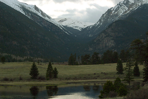
This is the valley surrounding Horseshoe Park looking towards the west.
We stopped at Sheep Lakes, an area frequented by Bighorn Sheep, where we saw more elk.
The sun was setting and it was getting dark by this time, so we left the park. We would spend the next day visiting more of Rocky Mountain National Park.
Day 6 — Colorado National Monument, May 2005
In May 2005, Rachelle and I took a vacation to Colorado. After our slight detour into Utah to visit Arches and Canyonlands National Parks, we returned to Colorado and drove the scenic Rim Rock Drive through Colorado National Monument.
Colorado National Monument
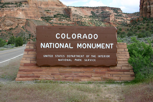
The park sign welcomed us as we entered Colorado National Monument.
Colorado National Monument lies along the edge of the Uncompahgre Uplift above the Grand Valley of the Colorado River. This region is part of the greater Colorado Plateau, a vast area of scenic wonders that covers 130,000 square miles in southeastern Utah, northern Arizona, northwestern New Mexico, and western Colorado. Other National Parks found on the Colorado Plateau include Bryce Canyon, Zion, Arches, Canyonlands, Mesa Verde and Grand Canyon.
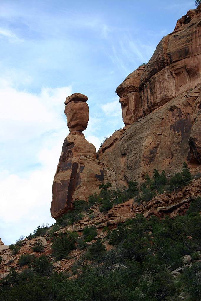
This formation is called Balanced Rock.
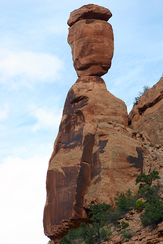
This was the third formation we saw during our trip with the name Balanced Rock, and the second one that day.
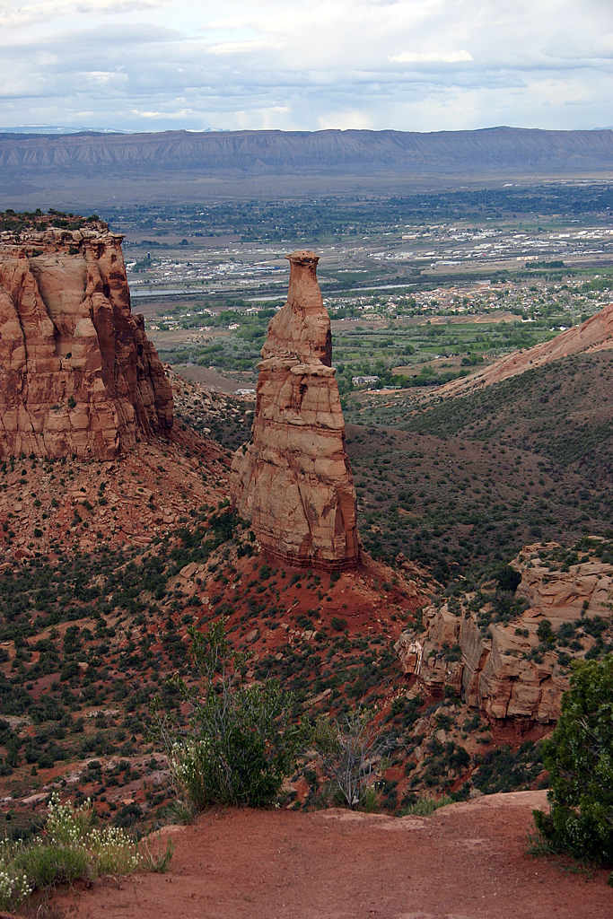
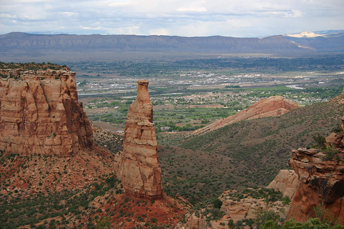
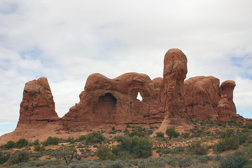
Independence Monument is one of the park’s most well known formations.
While we were taking in the view, another visitor was talking on his cell phone to his son who had just climbed to the top of Independence Monument.

Then, we drove to Grand View to see the backside of Independence Monument.
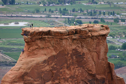
Here’s a photo of the climbers atop Independence Monument.
One last look at Independence Monument.
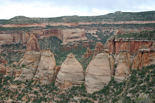
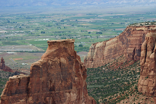
Next, we stopped at Coke Ovens Overlook.
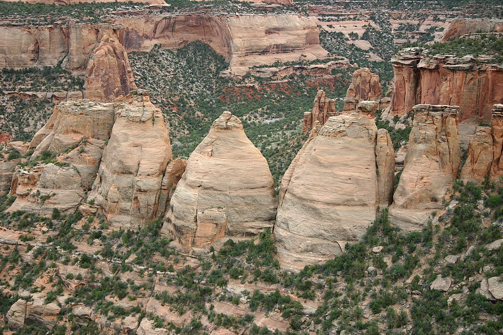
These massive white sandstone formations were named for their similarity to the kilns used to convert charcoal into industrial coke, which is used to smelt iron ore.
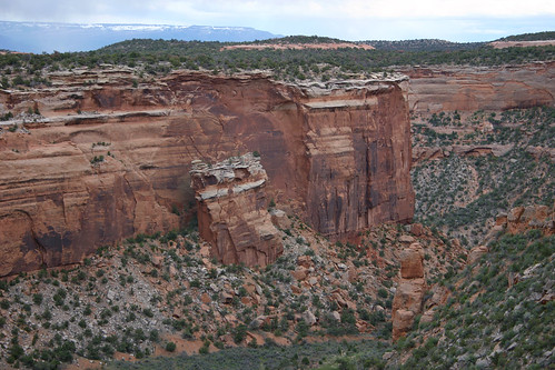
At Fallen Rock Overlook we saw the enormous section of canyon wall which fell to the canyon floor.
Our last stop was Red Canyon Overlook. From this vantage point we could see down the length of Red Canyon. The canyon has two distinct features: the U-shaped canyon with its sheer cliff walls, and the smaller, slender V-shaped depression in the center of the canyon floor. The rock of the cliffs is softer and has eroded faster; but the hard rock of the canyon floor has proved more resistant.
After a busy day of sightseeing, we headed east towards Denver. We planned to spend the next couple of days at Rocky Mountain National Park before heading home.
Day 6 — Canyonlands National Park, May 2005
In May 2005, Rachelle and I took a vacation to Colorado. During our trip, we took a slight detour into Utah. After visiting Arches National Park, we decided to briefly visit Canyonlands National Park. Canyonlands is divided into three separate parts by the Colorado and Green Rivers. We only had time to visit the Island in the Sky District.
Canyonlands National Park
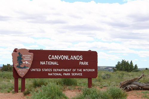
The park sign greeted us as we entered Canyonlands National Park.
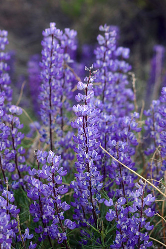
Just like at Arches, the wildflowers brought color to the desert.
After stopping at the Visitor Center, we took a short hike for our first views of the canyon.
Near the Visitor Center, we had our first look at one of the canyons from which the park derives its name. This viewpoint overlooks Shafer Canyon which leads to the Colorado River.
The La Sal Mountains rise majestically above the canyons.
Next, we drove to the southern end of the road, stopping at the Orange Cliffs Overlook to eat lunch and take in the awesome scenery.
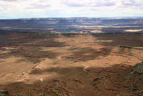
From this overlook we had a view of the canyon that was carved by the Green River.
In the distance from this overlook, we could see the Maze District, one of the other areas of the park.
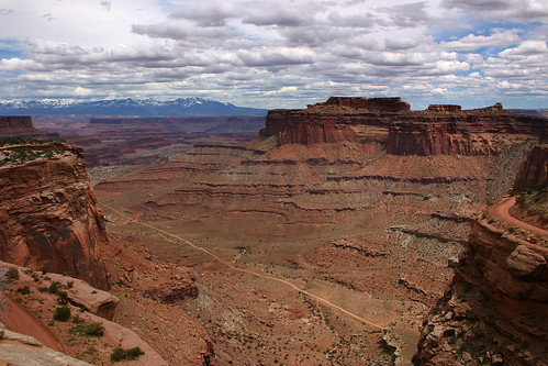
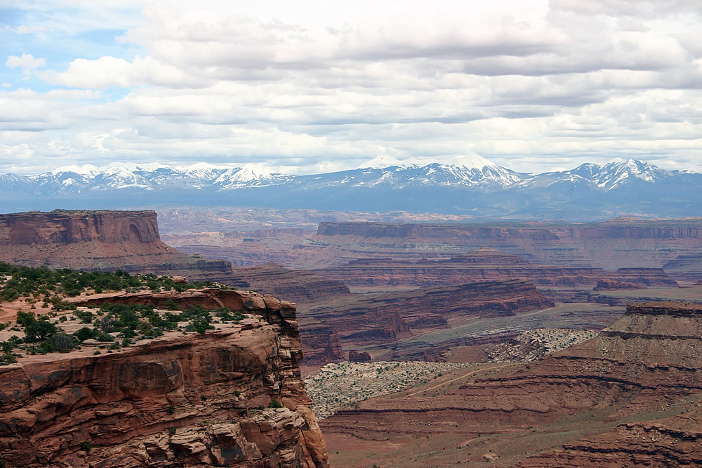
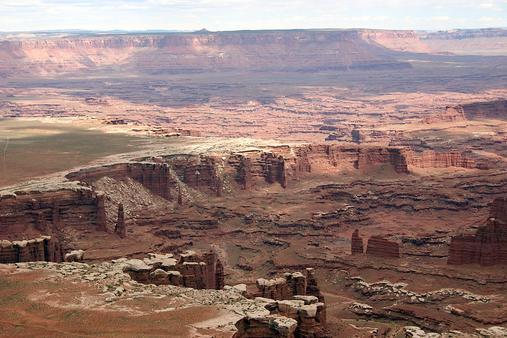
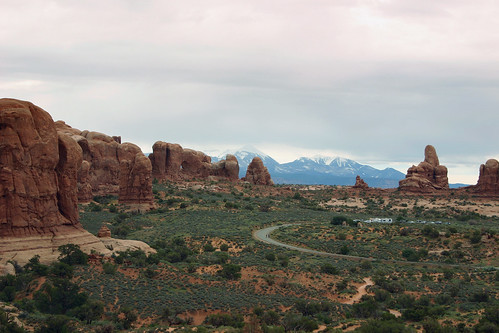
Next, we headed to the Grand View Point Overlook, the southernmost viewpoint in the Island in the Sky District.
In this photograph the White Rim Road is visible. It is an unpaved road which gives visitors to the park access to the lower canyon rim. Unfortunately, we did not have time to spend driving the road, so we had to settle for this spectacular view.
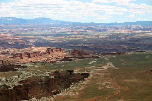
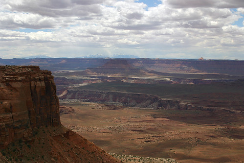
From this vantage point the Green and Colorado Rivers were not visible. The rivers have cut deeper, narrower channels in the broad canyons we saw. Somewhere below us the Green River joined the Colorado on its journey south.
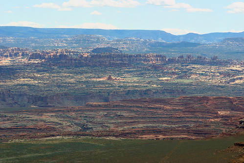
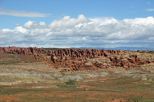
From this distance the spires of the Needles District look very similar to the Fiery Furnace of Arches National Park.
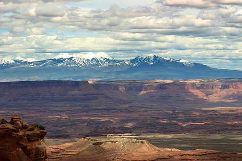
The snow-capped peaks of the La Sal Mountains tower above the landscape.
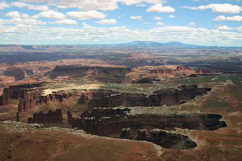
Our last view of Canyonlands: a close-up of White Rim below us. Canyonlands reminded both Rachelle and I of the Grand Canyon on a smaller scale.
It was time to end our brief visit to Canyonlands National Park. We left and headed back to Colorado where we would make a brief visit to Colorado National Monument.
Day 6 — Arches National Park, May 2005
In May 2005, Rachelle and I took a vacation to Colorado. After riding on the Durango & Silverton Narrow Gauge Railroad, we made a detour in our travel plans and drove through eastern Utah to visit Arches National Park. This was our second trip to Arches National Park; our first visit was in September 2001.
Arches National Park
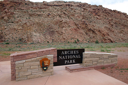
The park sign greeted us as we entered the park.
The highlight of our previous visit to Arches was hiking out to Delicate Arch. On this trip, we had planned to hike out to Delicate Arch first thing in the morning. But the overcast skies threatened rain, so we decided to spend our time visiting areas of the park we had not explored on our prior visit.
Here’s a view of the cloudy skies with the La Sal Mountains in the background. In the foreground are the Petrified Dunes. This is an inaccurate description since only organic material can be petrified. These rocks were at one time sand dunes which were compressed into these sandstone formations.
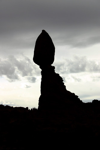
This mammoth formation is aptly named Balanced Rock.
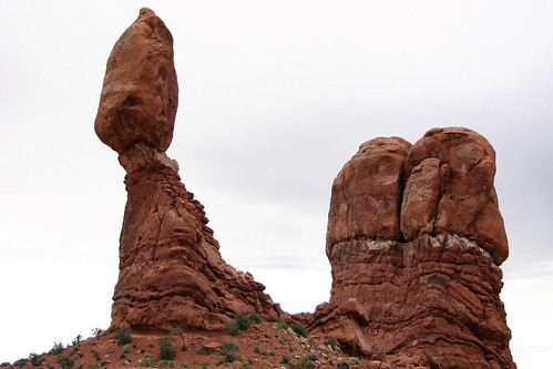
We hiked a short trail around this rock formation.
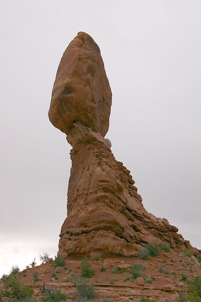
One last view of Balanced Rock. It would be the first of two formations we would see that day known by that name.
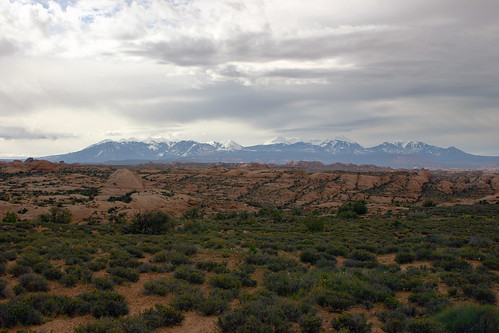
The snow-capped peaks of the La Sal Mountains make a stunning contrast to the landscape.
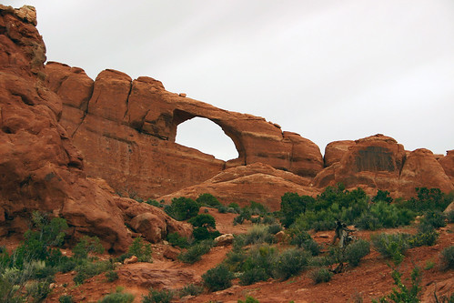
Next, we decided to hike a short trail out to Skyline Arch.

The arch became larger when a section of rock fell out of the arch in November 1940.
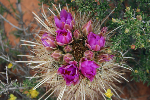
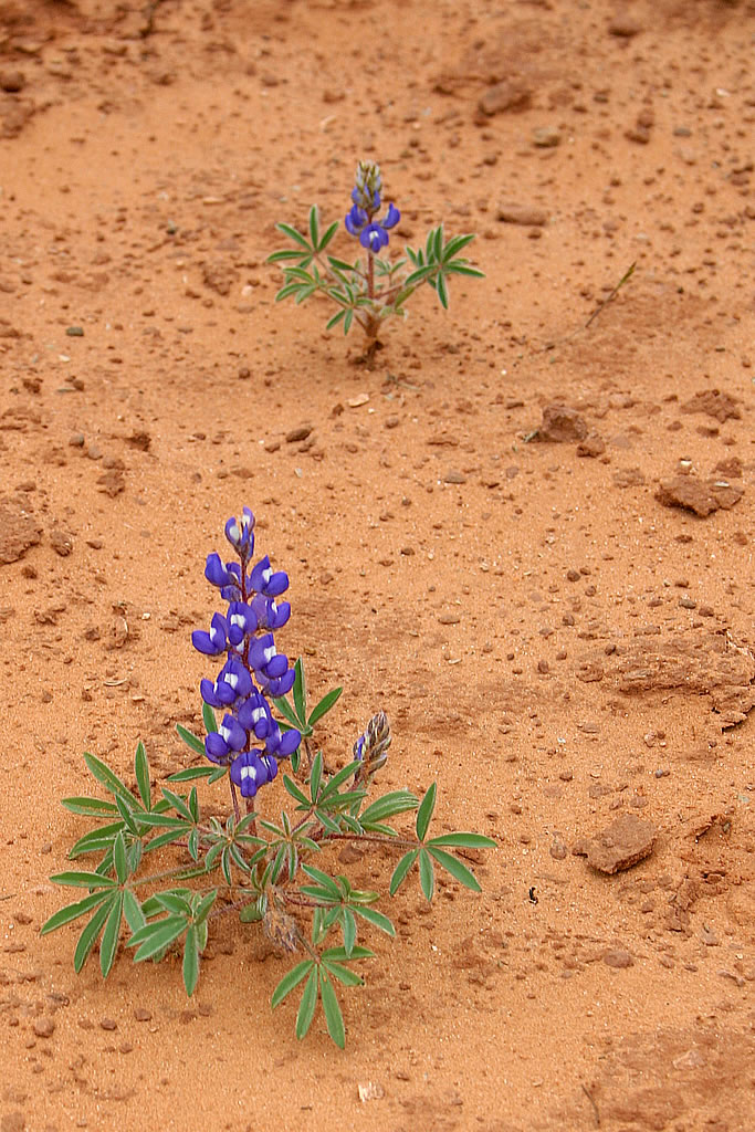
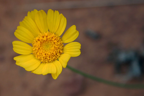
I was surprised by how much color the desert had. More color seemed to be present this trip than I recalled from our previous visit. I shouldn’t have been too surprised–it was springtime after all. Here’s one of the wildflowers in bloom we passed on our hike.
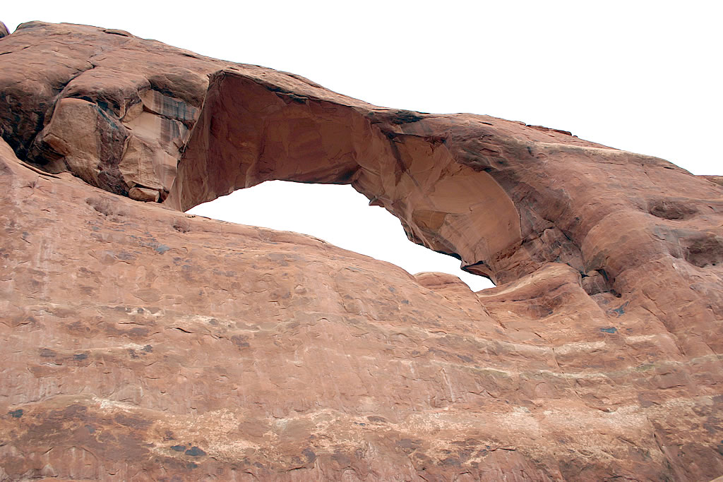
A view from the base of Skyline Arch. Right next to the spot where I took this photograph at the end of the trail lie the remains of the large boulder which fell out of the arch.
One last view of Skyline Arch as we headed back to the parking lot.
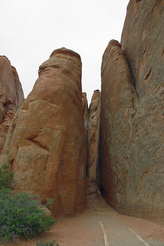
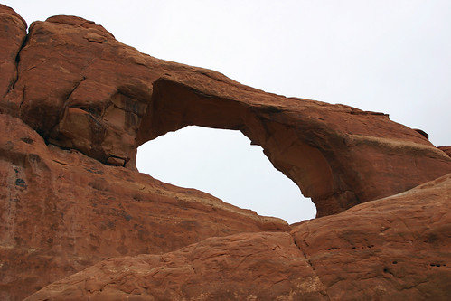
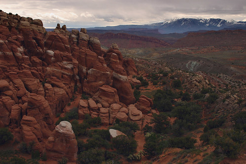
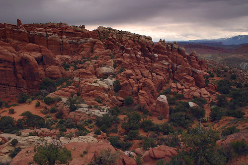
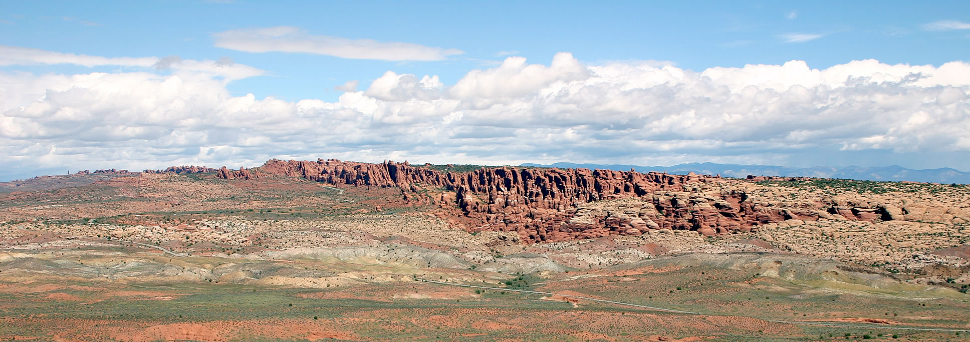
Next, we decided to take another short hike to Sand Dune Arch. The trail goes between some of the many rock fins which can be seen throughout the park. The presence of the rock fins is a neccessary ingredient in the formation of the park’s numerous arches.
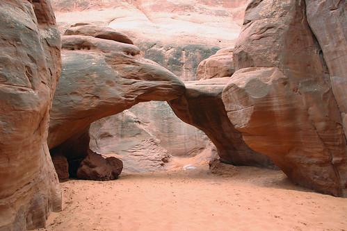
I am guessing that Sand Dune Arch gets its name from the sand that covers the ground around it. Otherwise, the name makes no sense to me.
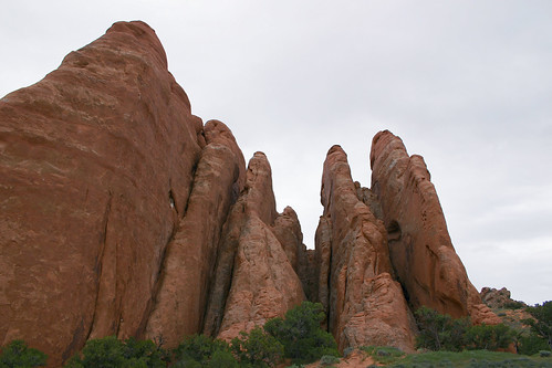
On our way back to our car, we passed several rock fins.
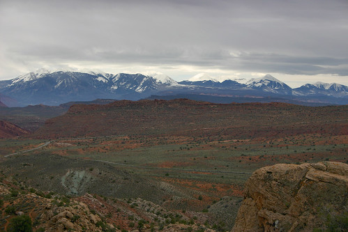
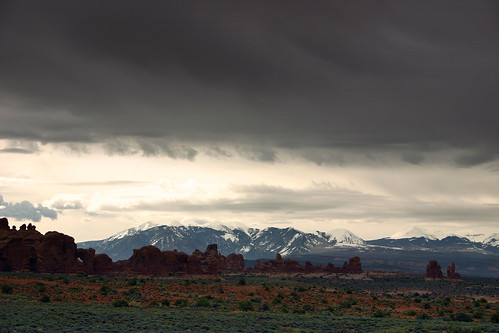
The La Sal Mountains tower above Salt Valley.
Next, we stopped at the Fiery Furnace which is named for the reddish glow the red sandstone takes on at sunset. We had visited this area on our last visit to Arches, but liked it enough to stop and view it again. This photo shows the edge of the Fiery Furnace, Salt Valley and the La Sal Mountains in the background.
Some time I’d like to return to Arches and take a hike through this area. And also to stay until sunset to see the rocks glow red.
Next, we drove to the Windows Section which we had visited before, but we didn’t hike out to Double Arch on that trip which I had regretted. So Double Arch became one of the sights I had to see this time around.
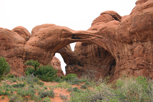
The arch isn’t too interesting from the parking lot, but once I got closer the enormity of this formation (third largest in the park) became obvious.
Along the way, I passed more evidence of Spring’s influence on the desert.
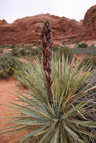
Here’s more plant life.
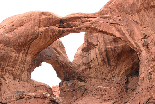
At the end of the trail, the two spans of Double Arch loomed over me. At the bottom of this photograph, you can see another hiker, standing underneath the front span.
I spotted yet another wildflower as I approached the arch.
I climbed up to stand underneath the back span of Double Arch. I took this photo of the scenery; North Window is just barely visible.
As I headed back towards the car, I passed this formation named Parade of Elephants.
Next, we stopped at Panorama Point to take in a spectacular view of Salt Valley and the Fiery Furnace. You can also view a panoramic photo of this amazing view.
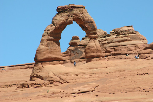
The sky was clearing by this time, but we decided it was too late in the day for us to hike to Delicate Arch and still visit the other places we wanted to that day. So we contented ourselves with viewing Delicate Arch from the Delicate Arch Viewpoint.
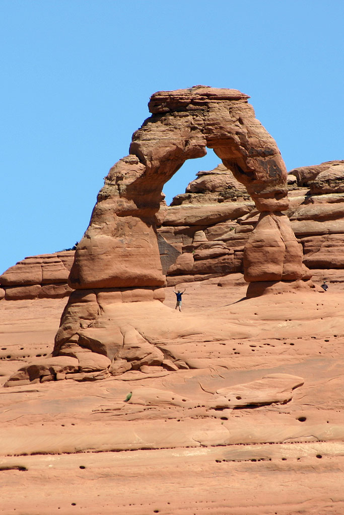
An intrepid hiker celebrates under Delicate Arch.
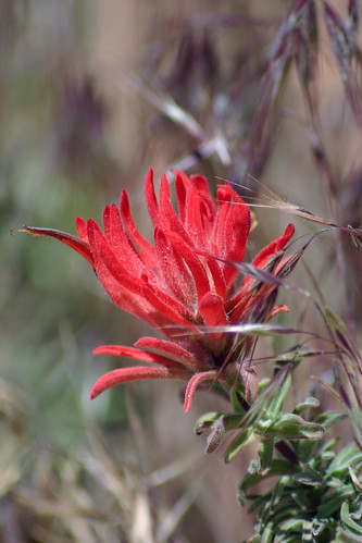
Along the way to the viewpoint, we passed more wildflowers.
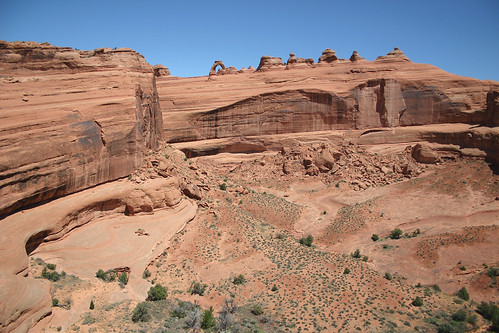
From the viewpoint, we could see Delicate Arch along the sandstone ridge opposite us, and the wash below it.
We were not alone at the viewpoint.
Another hiker poses under Delicate Arch.
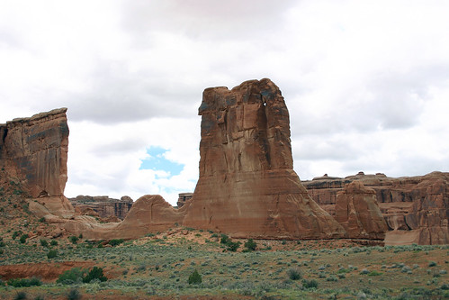
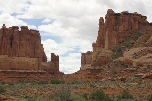
After we made our way back down to our car, we were ready to leave the park. On our way out, we stopped to take some photos of the Courthouse Towers section of the park.
Our next destination was nearby Canyonlands National Park.
The Legend of Deep Throat
The Legend of Deep Throat – Peggy Noonan looks at Mark Felt and the repercussions of Watergate
Even if Mr. Felt had mixed motives, even if he did not choose the most courageous path in attempting to spread what he thought was the truth, his actions might be judged by their fruits. The Washington Post said yesterday that Mr. Felt’s information allowed them to continue their probe. That probe brought down a president. Ben Stein is angry but not incorrect: What Mr. Felt helped produce was a weakened president who was a serious president at a serious time. Nixon’s ruin led to a cascade of catastrophic events–the crude and humiliating abandonment of Vietnam and the Vietnamese, the rise of a monster named Pol Pot, and millions–millions–killed in his genocide. America lost confidence; the Soviet Union gained brazenness. What a terrible time. Is it terrible when an American president lies and surrounds himself by dirty tricksters? Yes, it is. How about the butchering of children in the South China Sea. Is that worse? Yes. Infinitely, unforgettably and forever.
Ben Stein: About ‘Deep Throat’
Ben Stein shares his thoughts about ‘Deep Throat’ – From Stones Cry Out
Day 5 — Durango & Silverton Narrow Gauge Railroad, May 2005
In May 2005, Rachelle and I took a vacation to Colorado. After visiting Black Canyon of the Gunnison National Park and driving the Million Dollar Highway over the San Juan Mountains, we spent the night in Durango. And the next morning, bright and early, we boarded the train on the Durango & Silverton Narrow Gauge Railroad.
Durango & Silverton Narrow Gauge Railroad
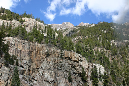
The first part of the ride is pretty uneventful–just leaving Durango. But once we were in the mountains, I left my seat in a covered car to brave the cold air of an uncovered car to take some photos of the beautiful scenery.
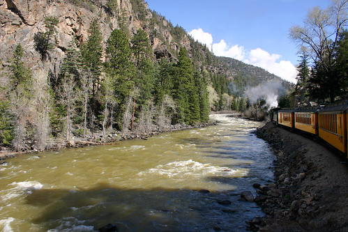
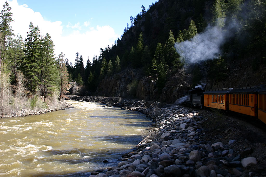
The path of the train follows the Animas River from Durango to Silverton. Over about 45 miles of track the train climbs almost 3000 feet in elevation. The original purpose of the train was to haul silver and gold out of the mountains back to the smelter in Durango. The track was laid in an astonishing eleven months and was operational immediately.
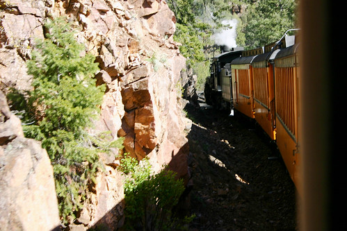
Here’s a photo of the train engine as we rounded a bend in the track.
Here’s another one. The rock wall was close to the side of the train.
All of the locomotives used by the D&SNGRR are coal-fired and steam-operated. And yes, the cinders do get on you in the open cars, but the scenery is worth it.
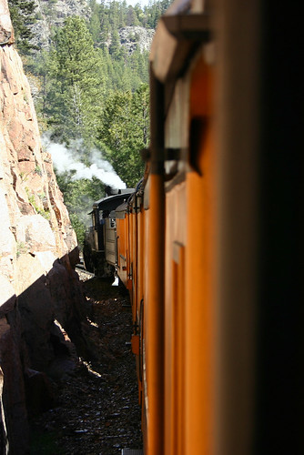
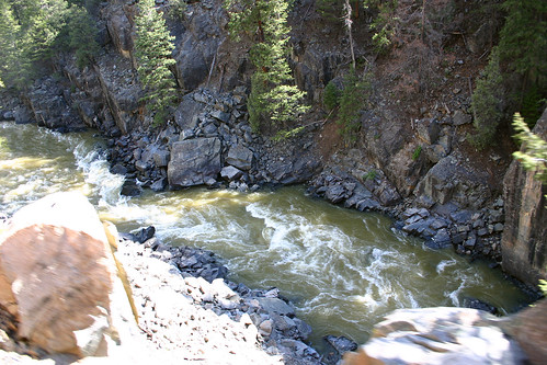
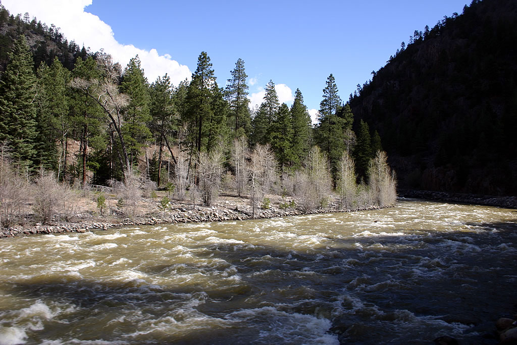
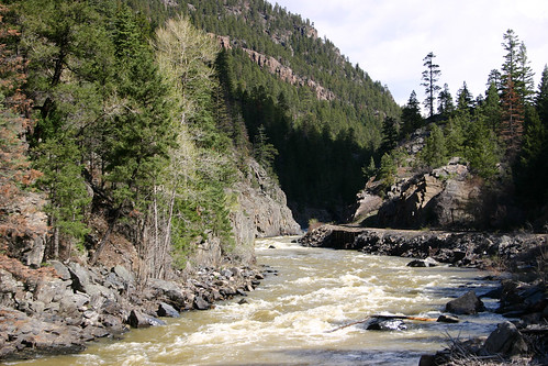
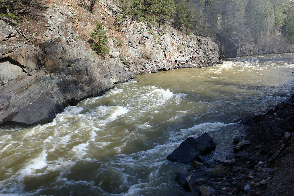
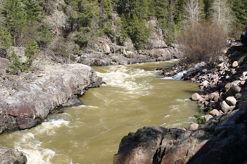
The Animas River is still below us.
It was really tricky to take photos on the train. The car swayed side-to-side, and the forward motion of the train didn’t give me much time to compose my shot: I had to point, click and hope for the best.
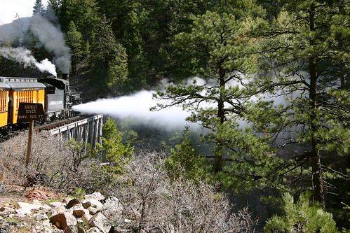
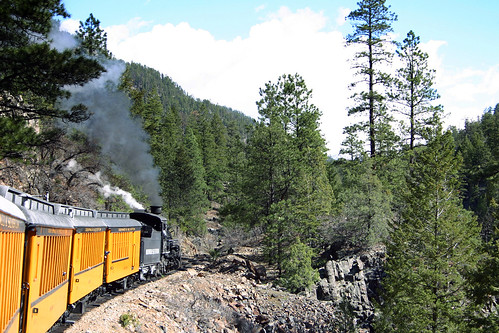
The engine blows out steam as it crosses the bridge. This bridge was featured in a couple of movies. It is the highest crossing of the tracks over the river at 70 feet, as I recall.
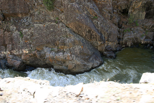
The river’s elevation matched that of the tracks.
Eventually, the train came to a stop to take on water. Since I didn’t think it would be so cold outside in the uncovered car, I had left just wearing just my sweatshirt. Big mistake! I was a bit cold, to say the least, by this time; so I went in to the comfort of the enclosed coach car to warm up.
Here’s the scenery from our pit stop.
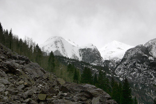
The mountains towered above us during our brief stop.
Silverton
After a three-and-a-half hour ride, we rode into Silverton. Rachelle and I decided to grab lunch and then explore the town. While we were eating, it began to snow lightly. Afterwards, we came back to the train and took some photos of it.
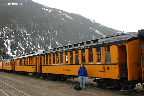
Rachelle posed in front of a covered coach car just like the one in which we rode.
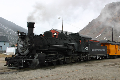
The engine of our train.
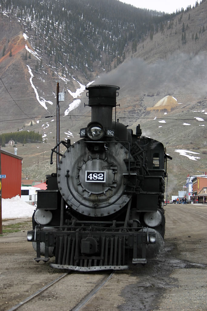
The front of our locomotive.
Our time was up in Silverton, so we got back on board and settled down for the return trip to Durango. It continued to snow lightly on us almost the entire trip back.
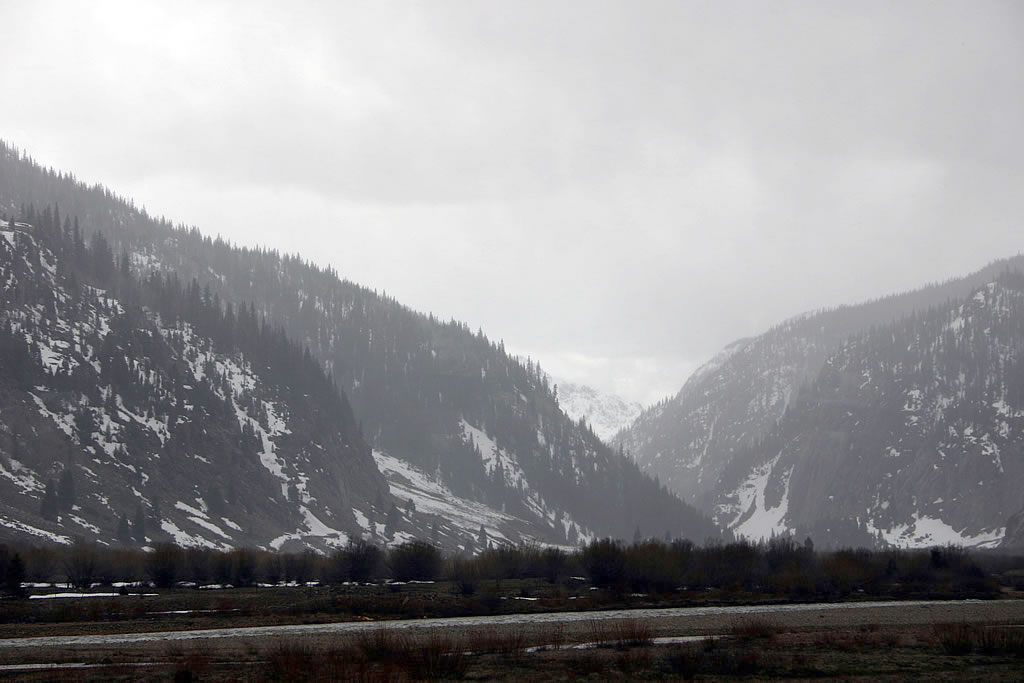
The view from the train as we left Silverton.
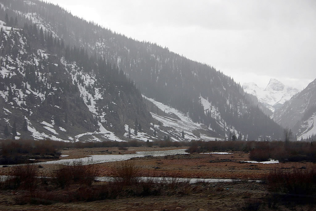
Another view of the stormy sky and the mountain scenery as we left Silverton.
The clouds shrouded the mountaintops on our return trip.
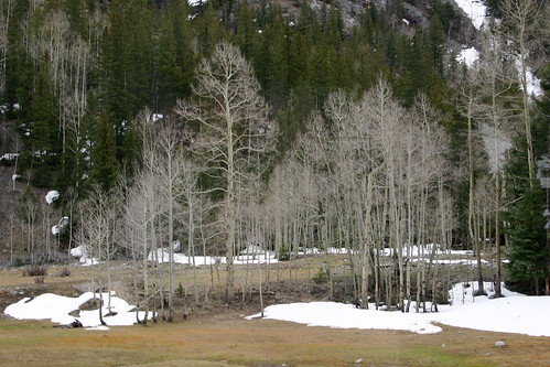
We passed lots of leafless aspens on our trip.
One last view of the mountains.
By the time we got back to Durango, it was late in the afternoon. With dusk approaching and the inclement weather in the mountains, we abandoned our original plan of driving back over the mountains and heading north. Instead, we decided to drive west first and then head north. In 2001, we had visited Arches National Park and throughly enjoyed the park and its unusual scenery. This diversion gave us an excellent excuse to re-visit Arches National Park, and see parts of the park we had left undiscovered on our previous visit. *[D&SNGRR]: Durango & Silverton Narrow Gauge Railroad