In May 2005, Rachelle and I took a vacation to Colorado. After visiting Royal Gorge, we crossed the Continental Divide and made plans to spend our fourth day in Colorado visiting Black Canyon of the Gunnison National Park.
Black Canyon of the Gunnison National Park
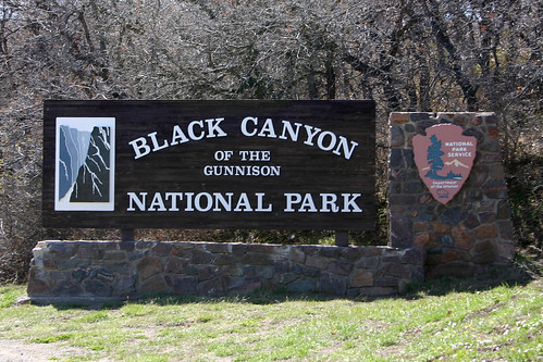
The National Park’s sign greeted us as we entered the park.
The Gunnison River carved the Black Canyon. Like Royal Gorge, the canyon is narrow and its walls are steep.
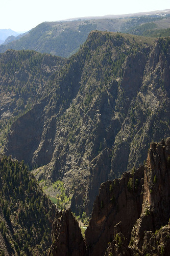
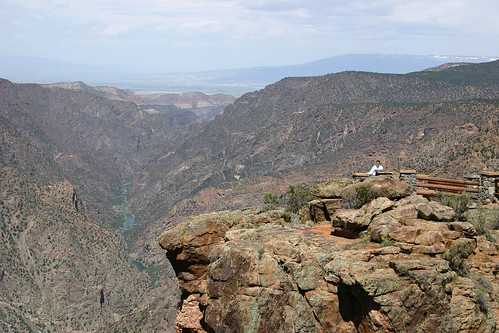
Our first stop in the park was at Tomichi Point. From here we had our first views into the depths of the canyon.
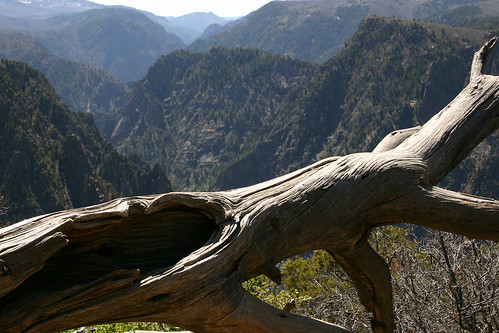
Rachelle took this photo of a dead tree guarding the canyon.
In the distance, the snow-capped peaks of the West Elk Mountains loom majestically over the canyon.
Next, we visited the Visitor Center and afterwards hiked the short trail out to Gunnison Point.
The Gunnison River’s usually steep descent and narrow channel cause the river to be quite loud. We were told that at the bottom of the canyon the river is deafening. Even at 1,840 feet above the river, we could easily hear the roar of the water as the Gunnison River rushed below us.
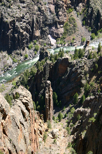
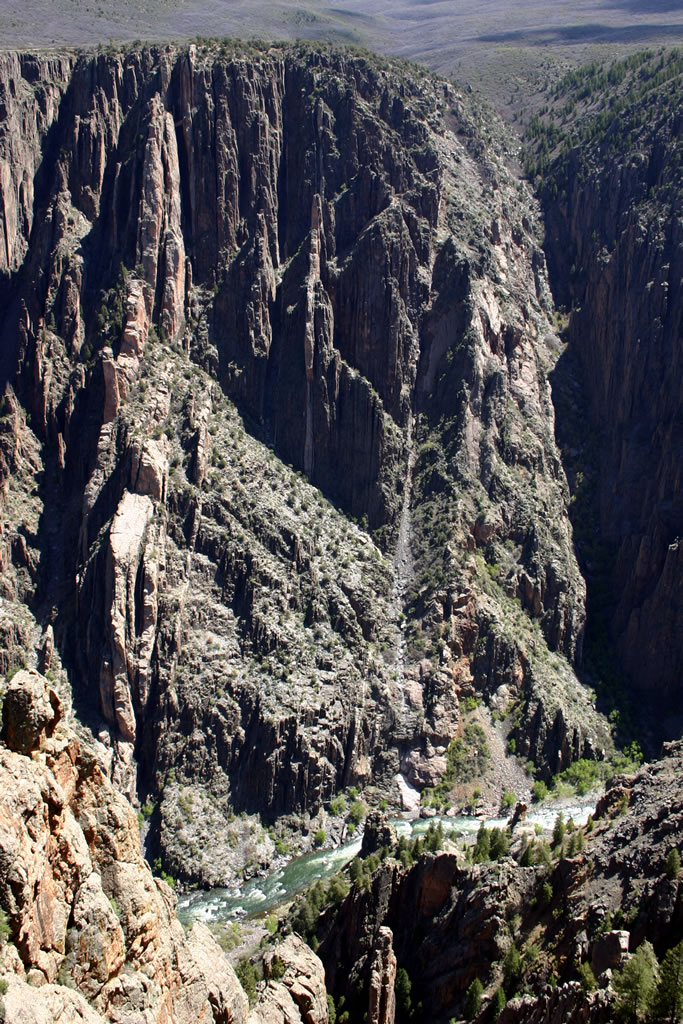
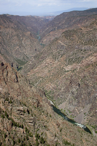
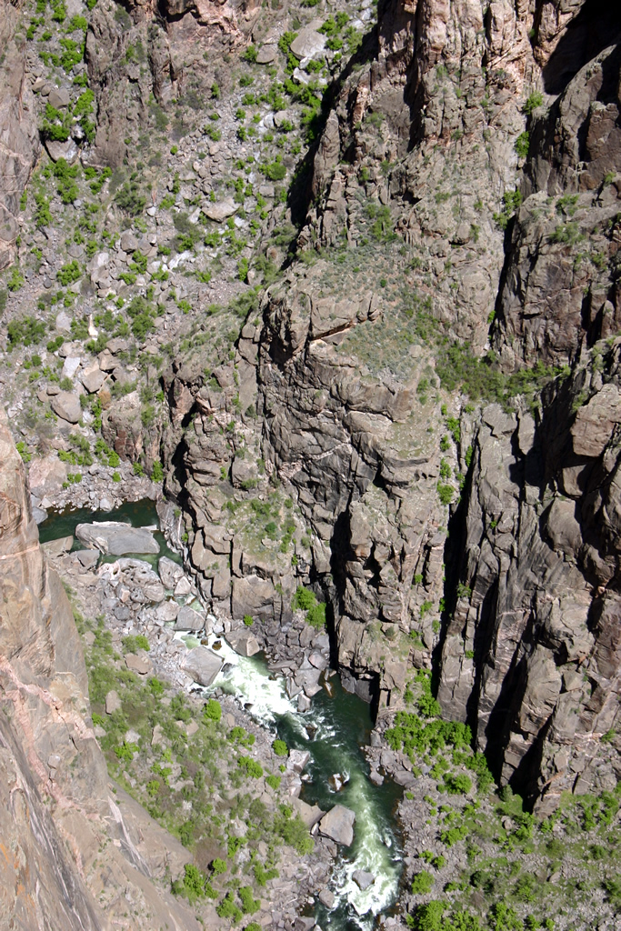
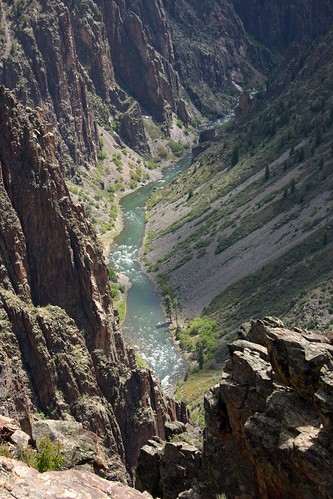
Here’s a close-up of the river and the canyon floor.
We drove to the end of the South Rim Road and worked our way back towards the park’s entrance along the rim.
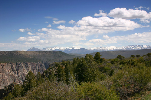
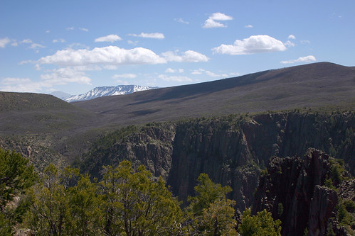
At the end of the South Rim Road is High Point. From here we had a spectacular view of the West Elk Mountains as they rose on the horizon.
Here I am posing for a photo at Sunset View.
The view from Sunset View as the Gunnison River continues on to the west.
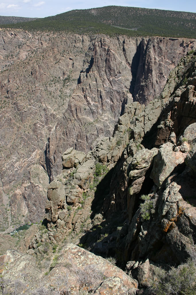
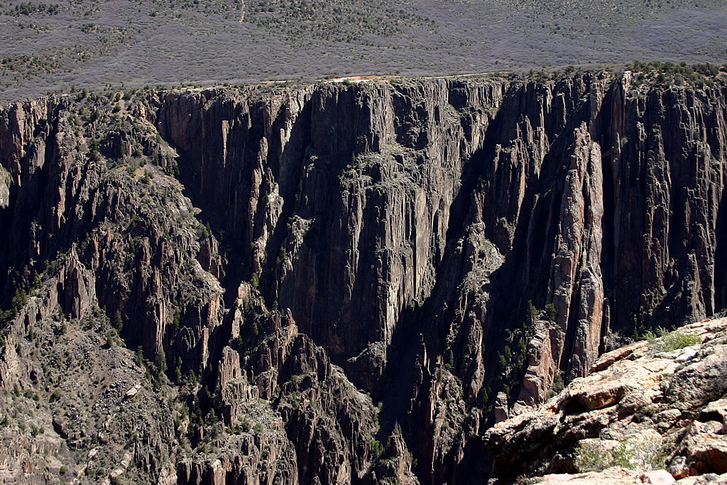
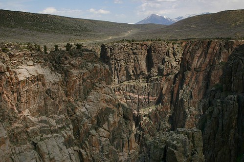
Here’s a view of the rough canyon walls.
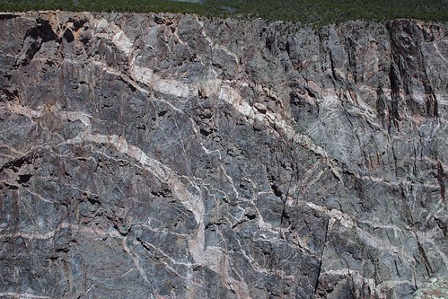
At 2,250 feet Painted Wall is the tallest cliff in Colorado. If you look closely enough you can see two dragons, one above the other. The pinkish color rock that forms the dragons is called pegmatite. The pegmatite was originally magma that was squeezed into the other layers of rock (schist and gneiss) that form the canyon walls. Other examples of pegmatite in the canyon are the pegmatite dikes visible at Gunnison Point. (Look for the pinkish rock fins extending from the opposite wall of the canyon.) The pegmatite is harder than the surrounding rock, so it is more resistant to erosion.
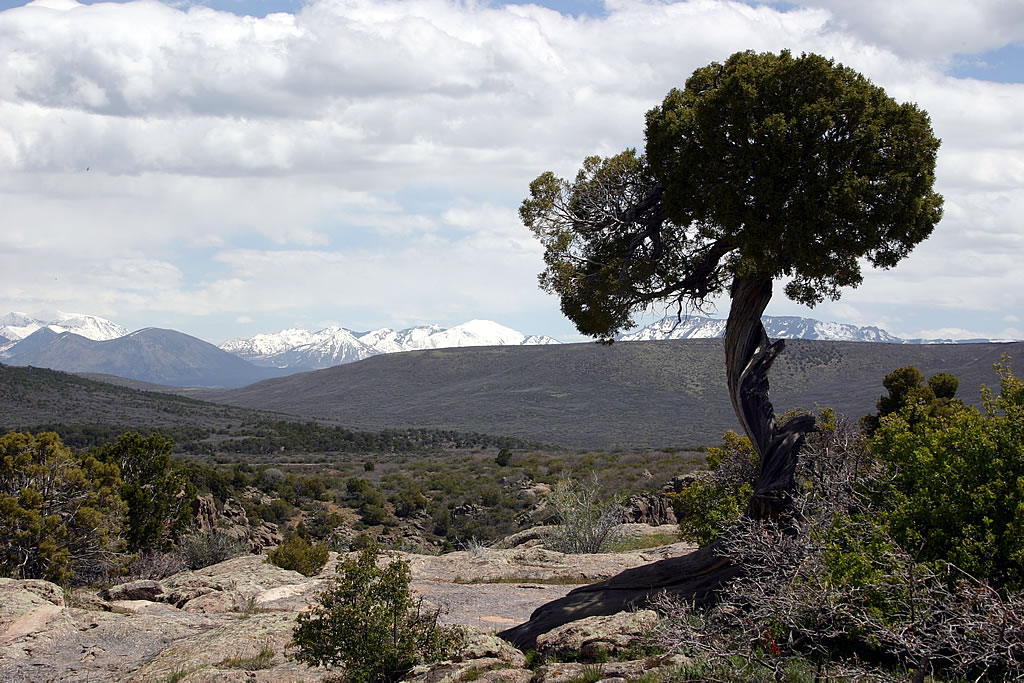
Rachelle took this photo of a gnarled juniper with the mountains in the background.
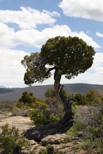
Then she took this close-up of the juniper itself. I’ve noticed several photos of this tree on other websites. This must be the most photographed tree in the park!
This photograph of the river was taken at Chasm View. As I mentioned before, the Gunnison River has an unusually steep descent. Over its 50 mile length through the gorge, the river falls 2,150 feet, an average drop of 43 feet per mile. The Colorado River in the Grand Canyon only descends an average of 7.5 feet per mile. The Gunnison’s greatest descent occurs near Chasm View at 480 feet in a two mile stretch (240 feet per mile average). Chasm View is also the narrowest point of the canyon along the rim at 1,100 feet from rim to rim.
The road through Grizzly Gulch to the North Rim is easily visible from Cross Fissures View. Also, notice the streaks of pegmatite in the canyon walls.
Pulpit Rock Overlook was our last stop in Black Canyon of the Gunnison National Park.
Million Dollar Highway
Rachelle and I had planned to be flexible on this vacation so we could see as much (or as little) as we wanted. After visiting Black Canyon of the Gunnison National Park, we were undecided about what to do next. We both wanted to take a train ride during the trip, but so far had been unable to work one into our travel plans. Being just a few hours drive from Durango and the Durango & Silverton Narrow Gauge Railroad, we called to see if we could get tickets for the train the next day. To our welcome surprise tickets were still available, so we took advantage of the opportunity and made plans to ride the train the following day.
To get to Durango we drove south along US 550 from Montrose, CO. The stretch of highway through the mountains south of Ouray to Silverton is known as the “Million Dollar Highway”. There are several explanations for the name of the highway: one is that the road is named for the value of low grade gold ore found in its roadbed, and another has it that the name was due to the high cost of building a road over Red Mountain pass (11,008 feet in elevation) along the Uncompahgre Gorge. Regardless, the scenery we saw along the drive south was definitely worth a million dollars.
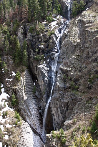
Along our drive we noticed several waterfalls caused by the snow melt.
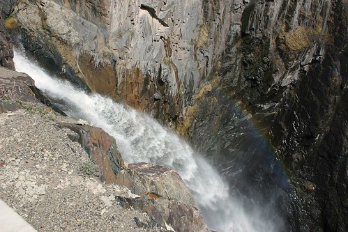
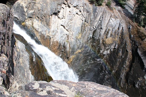
This waterfall was on the opposite side of the gorge from the one in the last photo.
Here’s another view of the waterfall and its rainbow.
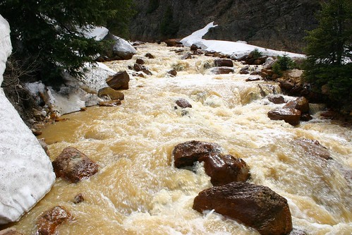
We also saw several swollen creeks with muddy water due to the snow melt.
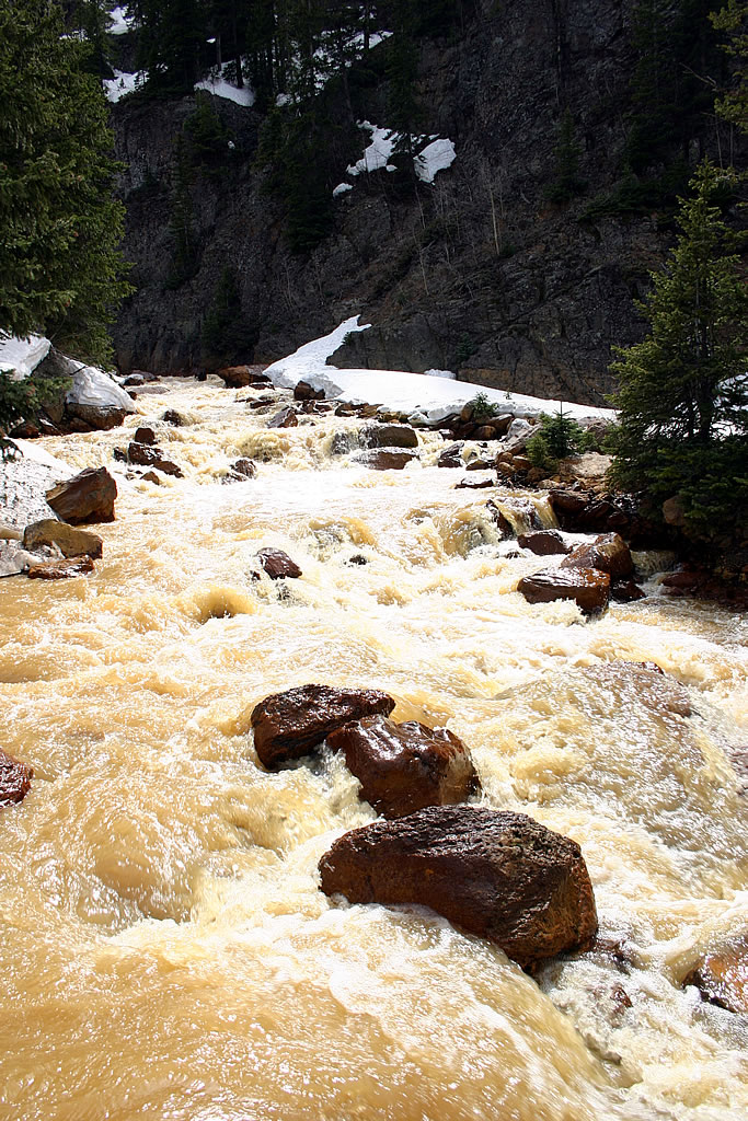
Here’s another photo of the same creek. Notice the snow. We had risen in elevation enough that snow was still lying on the ground
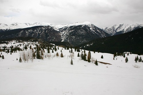
At Molas Pass (elevation 10,910 feet) we parked the car, walked around and enjoyed the awesome snowy scene around us.
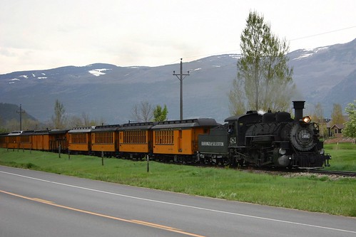
As we approached Durango, we passed the train on its way back from Silverton for the day.
The next day we would be passengers on the Durango & Silverton Narrow Gauge Railroad.