In September of 2004, I accompanied my wife, Rachelle, on a business trip to Las Vegas, NV. While she was in class, I entertained myself by visiting a variety of places in the region. When her class was over we took a long weekend, and visited several National Parks in California, before returning to Las Vegas for our trip home.
The first day of her class I decided to get up in the wee hours of the morning to drive the few hours to Joshua Tree National Park in Southern California. Fortunately, I had the time change working in my favor, so I was getting up at the usual time I would have if I were back home and going to work.
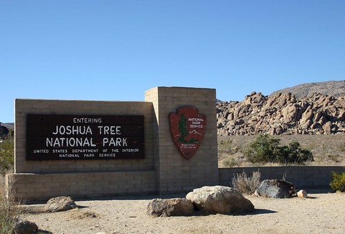
The park’s entrance sign welcomes me.
Two distinct desert ecosystems, the Colorado and Mojave, meet within Joshua Tree’s boundaries. The Colorado is the lower and drier of the two. My first stop within the park was the Cholla Cactus Garden which is in the Colorado Desert portion of the park.
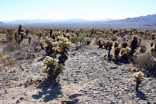
This is a view of the Cholla Cactus Garden facing south towards the Pinto Basin.
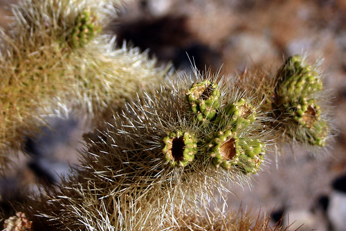
This is a close-up view of a cholla (pronounced choy-ya) cactus. The cholla has two nicknames. The soft appearance of the cholla’s spines gives it the first, “teddy bear”. But despite the nickname and appearance, the cholla’s barbs are actually quite sharp (or so I was told – I didn’t actually find out). This leads to its second nickname, “jumping cholla”. When something brushes against the cholla, the spine’s microscopic barbs will penetrate deep into it, and the joint will break free from the rest of the plant, which allows it to “jump” to a new location.
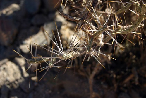
Here’s a closer look at another variety of cactus, named the pencil cholla for its long, pencil-shaped joints.
Next, I stopped at the White Tank Campground, which features the Arch Rock Nature Trail.
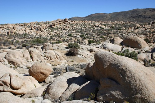
The campground is named for the large, white sandstone formations which dominate the landscape.
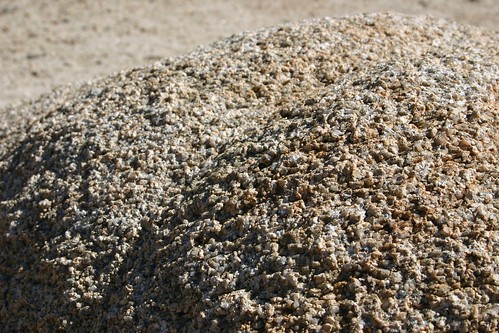
From a distance the sandstone looks smooth, but a closer inspection reveals the rough surface of these rocks.
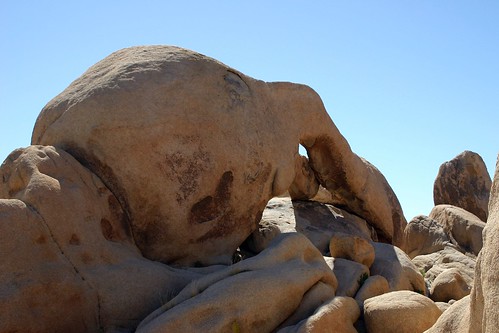
Arch Rock, for which the trail I was hiking is named.
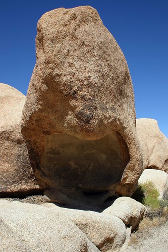
This immense piece of sandstone could provide shade and refuge to a weary traveler.
I left the White Tank Campground, and continued on in search of Joshua trees.

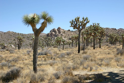
Finally, my first view of Joshua trees. I was surprised by the size, quantity and density of the Joshua trees.
I had only expected them to be five or six feet tall, and to be sparsely spread about the landscape. Imagine my surprise when I discovered this one which towered over me. And they were growing close together, like an orchard of Joshua trees had been intentionally planted.
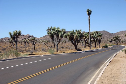
Here are several more Joshua trees which were together on the other side of the road.
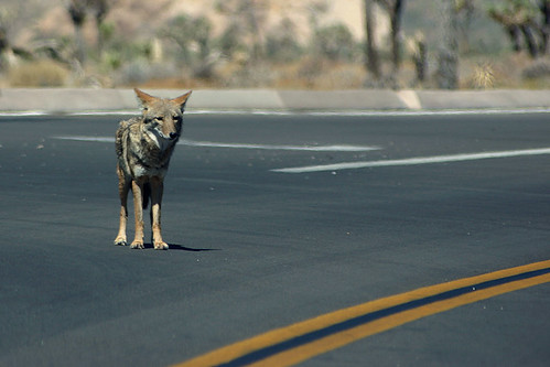
Next, I decided to make my way up to Keys View. Along the way, this coyote was standing in the road.
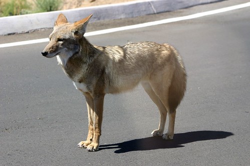
I was able to drive right up next to it, so I suspect, unfortunately, that this animal has been fed by other visitors driving by.
Here are some more Joshua trees I passed on the way up to Keys View. Again, it looks like a grove of planted Joshua trees.
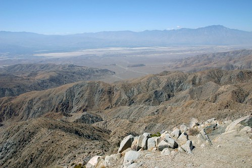
Keys View rises 5185 feet above sea level and offers a spectacular view facing southwest out of the park featuring the San Andreas Fault.
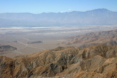
Here’s a close-up of the San Andreas Fault.
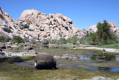
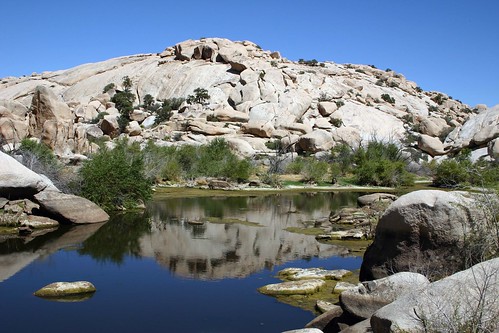
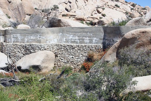
My last stop before leaving the park was a short hike out to Barker Dam. The dam was built around the turn of the 20th century to provide water for cattle. It has been left intact as a watering hole for wildlife.
Another view of the reservoir.
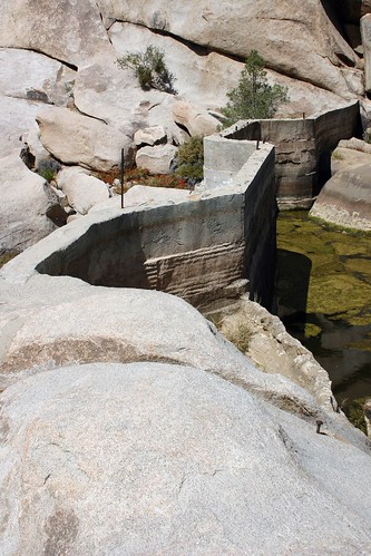
Here’s a view of Barker Dam from above.
And the picture below is a photograph of the dam from the back side.
By this time it was already mid-afternoon, and I had to leave in order to make it back to Las Vegas in time for dinner with Rachelle. There was a lot of the park I wasn’t able to see, so it just gives me an excuse to return in the future.