During the summer of 2001, my wife and I took a vacation to visit National Parks and Monuments in Utah and Arizona. Our first stop was Bryce Canyon National Park.
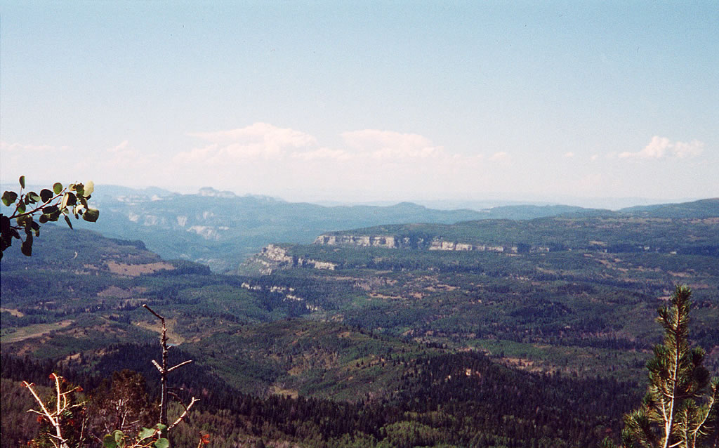
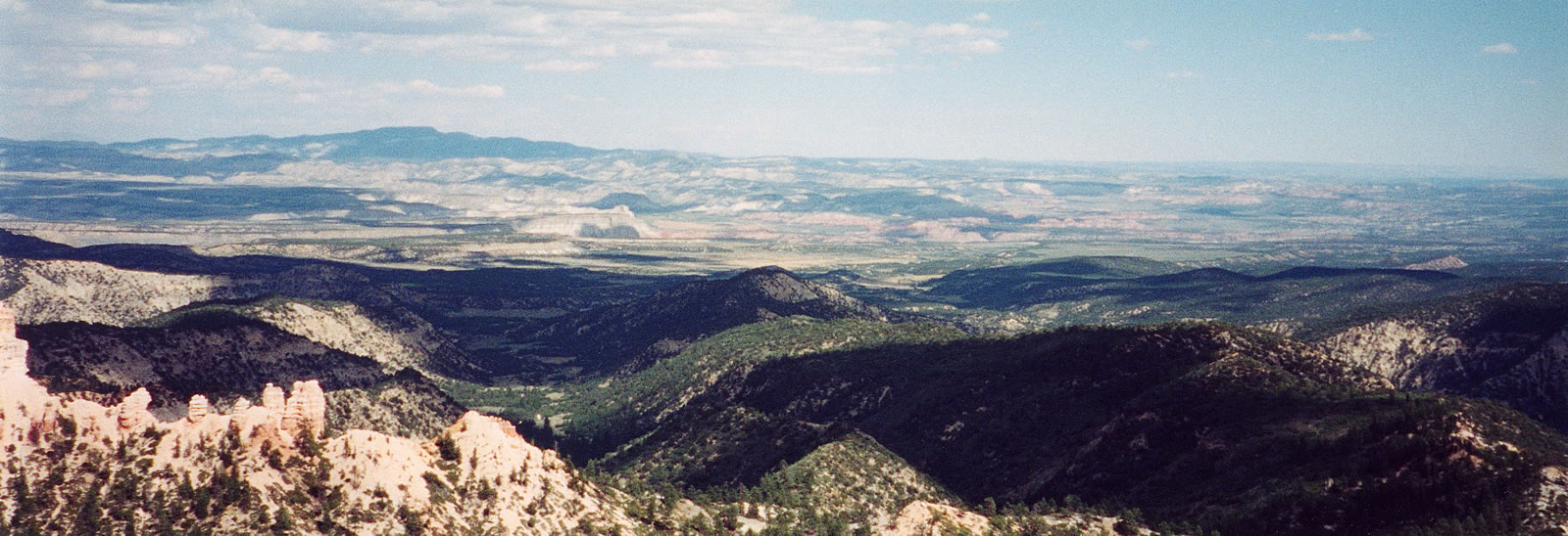
This picture and the next one were taken at a pull-over during our drive to Bryce. Both are indicative of the amazing views that greeted us. Niether of these pictures, though, can do justice to the granduer of the landscape that stretched out before us.

This photo was taken looking southwards in the general direction of Zion National Park.
Later on the drive, we passed a cinder cone and lava flow. We thought about walking out to it, but decided we did not want to spend the time it would take us to get to it and walk back to our car.
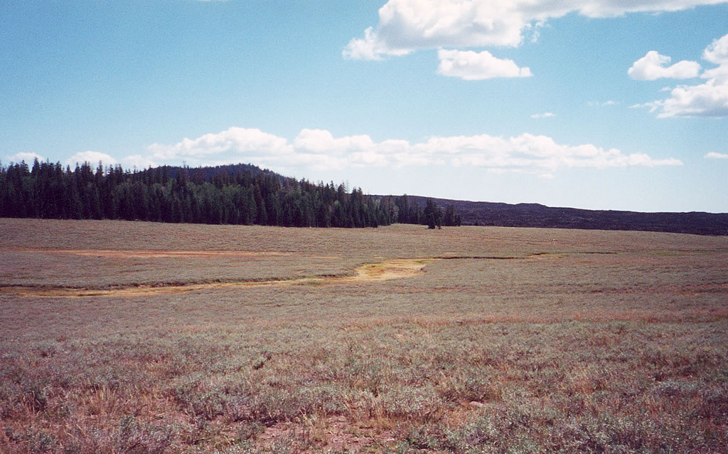
The cinder cone is the mound on the left side of the picture and the lava flow extends from the cone to the right side of the photo.
When we arrived at the park, we first visited the Visitor Center and then drove to the end of the main park road. At the end of the road are two lookout areas, Yovimpa and Rainbow Points.
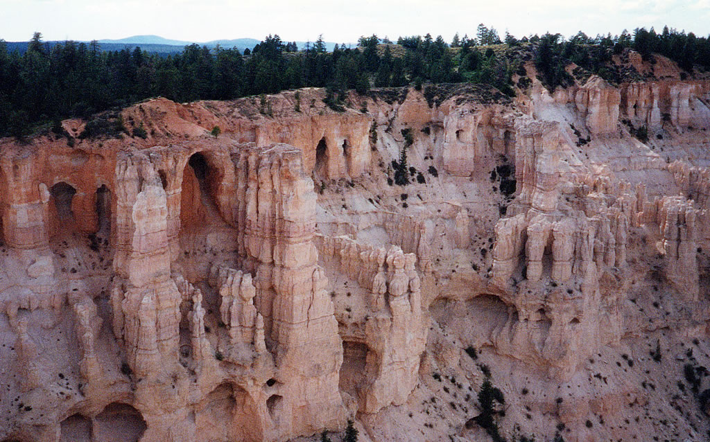
This photo and the next one are from Yovimpa Point. This was where we got our first view of the hoodoos for which Bryce Canyon is famous.

Hoodoos are rock formations, usually pillar-shaped, left by erosion.
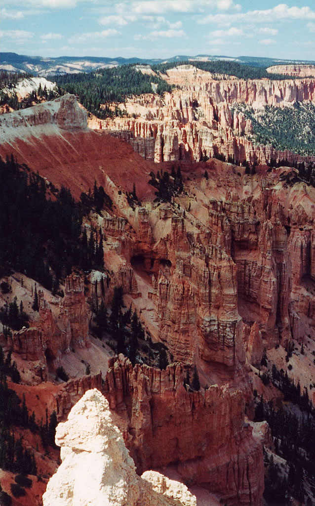
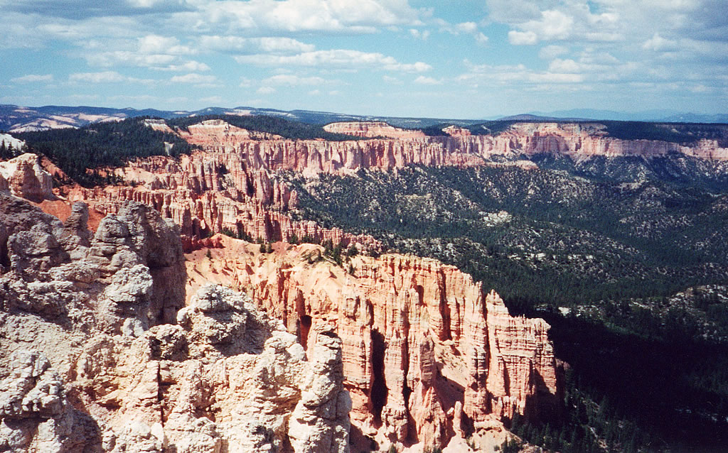
Next, we walked along a short path to Rainbow Point, which looks out north-eastward over the park.
From Rainbow Point visitors can see out to the nothern end of the park. It also gives great views of Grand Staircase-Escalante National Monument.
These two photos were taken looking east towards Grand Staircase-Escalante. In both of these photographs, more hoodoos can be seen.

I also took a panoramic photograph of the view from Rainbow Point. Looking east, the pink cliffs of Grand Staircase-Escalante National Monument are visible in the distance.
We then drove back towards the park entrance along the main park road. Stopping at some of the various viewpoints along the way.
This photo and the next one were taken from the same overlook. The one to the left is looking towards the southeast. Just barely visible in the distance is Navajo Mountain which is about 90 miles away.
The picture below shows a view of the bottom of the canyon. Bryce Canyon is actually misnamed. It is really the edge of the Paunsaugunt Plateau, which forms the western, higher part of the park. The plateau falls away into the Paria Valley, which lies between the Paunsaugunt and Aquarius Plateaus.
At one time these two plateaus were joined together, but time and geologic forces have eroded the land away, creating the beautiful rock formations found at Bryce.

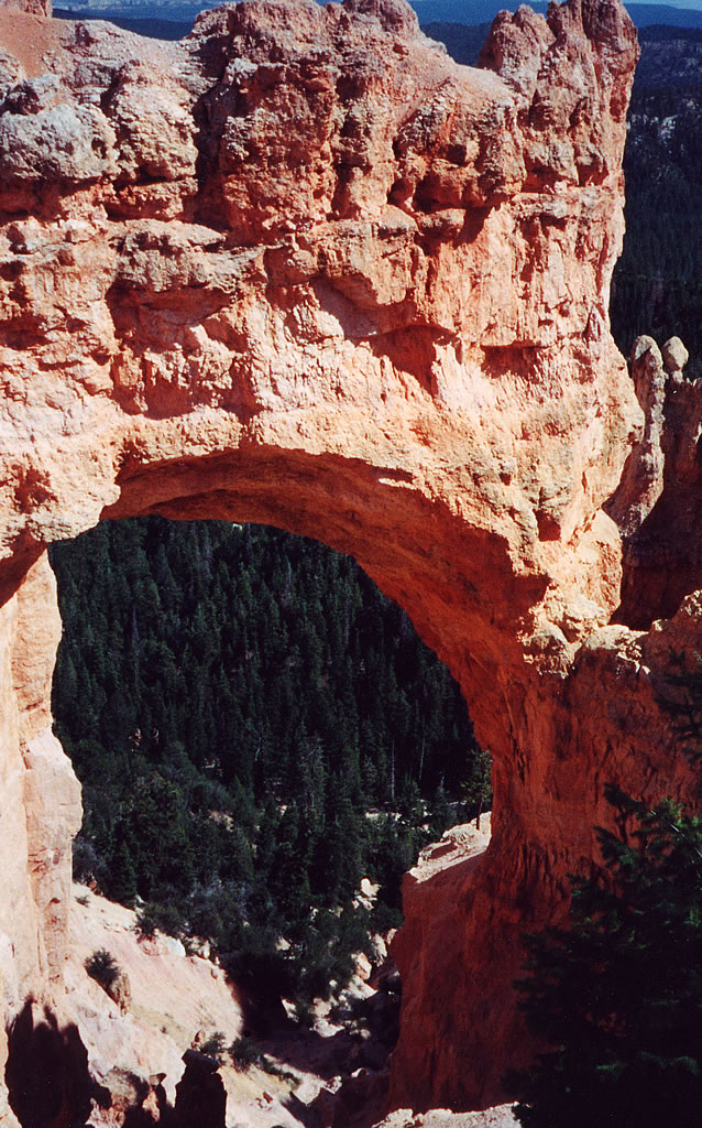
This enormous formation (so large I could not fit it into one photograph) is named Natural Bridge. But it was not formed by a stream as a real natural bridge would be. This formation is an arch, which is formed by the combined forces of rain and frost working upon the rock.
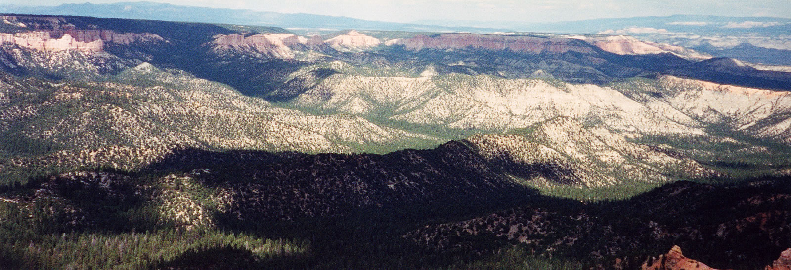
Next, we drove on to Farview and Piracy Points, which offer excellent views to the surrounding landscape. I took panoramic photos of the surrounding countryside from these vantage points looking to the southeast, east and northeast, offering a glimpse into the spectacular surroundings.
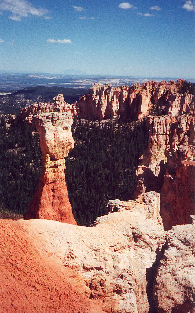
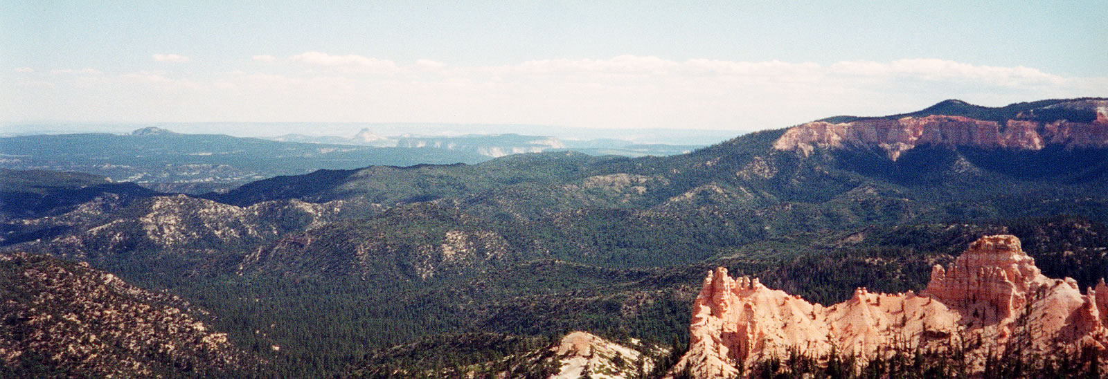
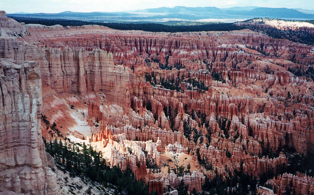
From Farview Point we drove to Bryce Point, which offers an incredible view from the southern end of Bryce Ampitheater. Byce Ampitheater is the largest of the natural ampitheaters located within the park’s boundaries.
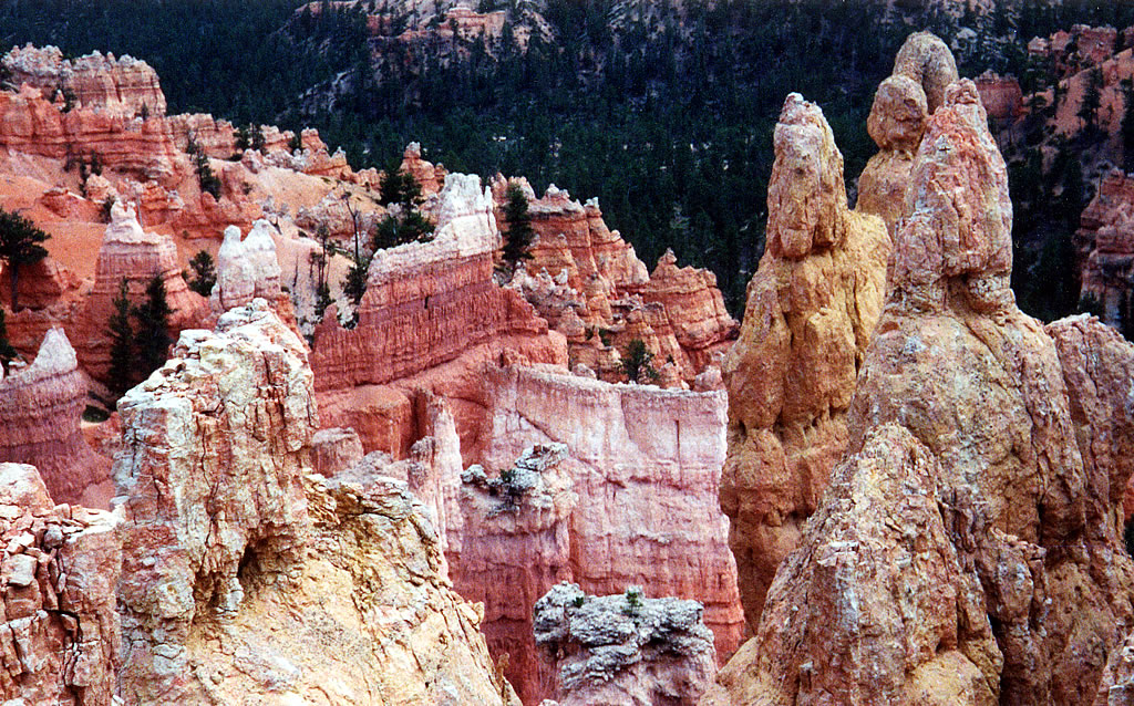
Here is a closeup of some of the cathedral-like formations which ring the top of the ampitheater.
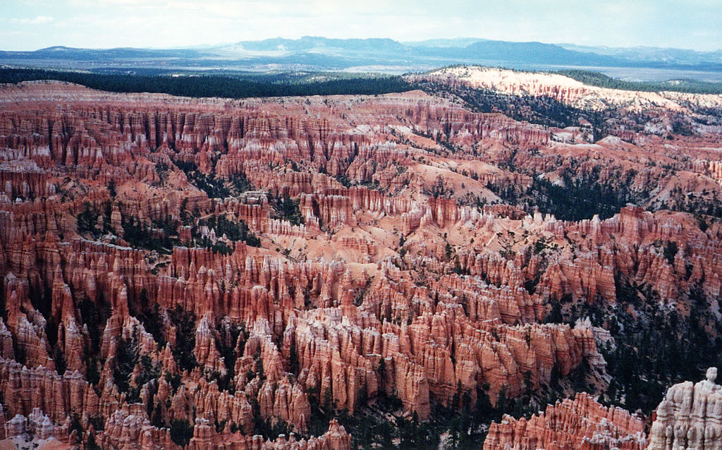
This is a photo looking down from the rim into Bryce Ampitheater. This photo shows the enormous number of hoodoos found in this part of the park.
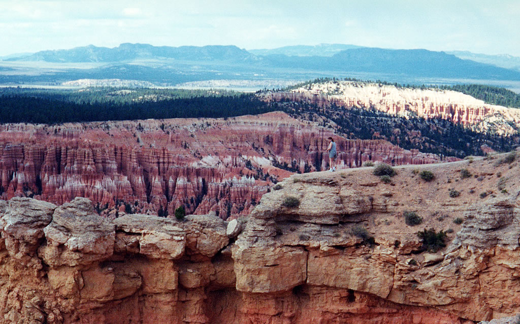
And here is a photo of my wife standing on a rock outcropping which overlooks Bryce Ampitheater.
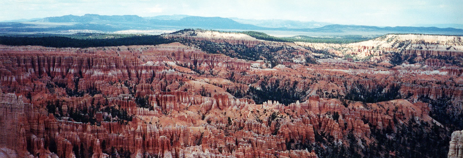
Here is yet another view looking down into Bryce Ampitheater. I also took a panoramic photo of this part of the park.
We then drove to the other end of Bryce Ampitheater to Sunrise Point, where we decided to hike down into the canyon along the Queens Garden Trail.
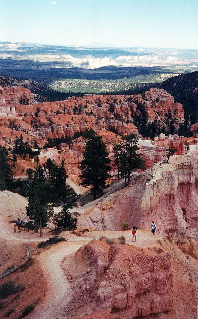
Here we are near the trail head looking down along the trail. So far not so bad.
When we began this hike, we thought we’d only hike down a little way along the trail and then go right back up. We were looking for a short, not too strenuous hike.
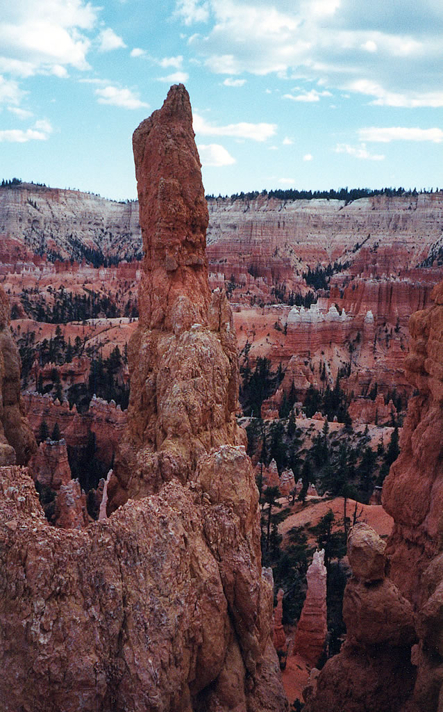
The photos to the left and below show some of the rock formation we saw as we hiked down the Queens Garden Trail.
Before we knew it we were near the bottom, so we decided to continue our hike and climb back up on the Navajo Loop Trail by Sunset Point. And then hike back to our car by the Rim Trail.
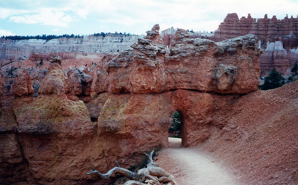
As we hiked along the trail, we passed under several arches just like the one in the photograph above.

Here is a picture of a tree growing up out of the canyon floor. This part of the park is called Wall Street for the nearly vertical walls of rock on both sides of the trail.
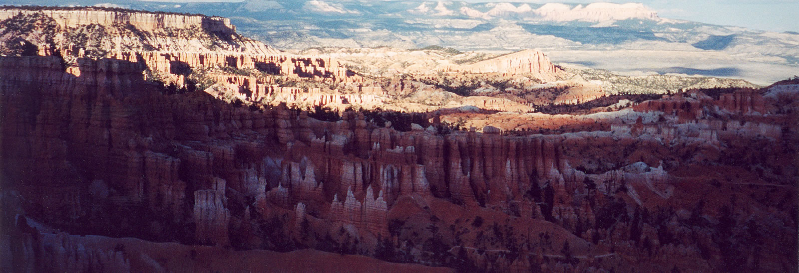
After we had climbed back to the top of the canyon, I took one last panoramic photo of Bryce Canyon in shadow from Sunset Point.
The next day, we visited Zion National Park.